Use this topic for posts to collect community stars for the Hammond Hill Hoctathon course.
Here’s how it works.
Click the “Post Using This Template” button below to create a new post with a Story heading and boilerplate text.
Replace the boilerplate text with your report for one or both sections. The header is key for distinguishing between posts and replies—don’t change it.
Your post must be on the same calendar day as your run as entered in Webscorer.
Story
To pick up a community star, replace this text with a write-up of what your run was like, a photo you took on the run, a link to your Strava track, or something similar. Don’t delete the Story heading above.
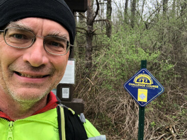
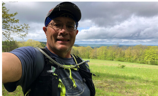
I scanned the sign 3 minutes later than hoped, at 12:04, and immediately realized I hadn’t changed out of the road shoes I put on for the car ride. So after another two-minute delay I got moving at a decent pace for a Hammond headlamp run. The Hoctathon was fun to run in the dark in this forest where I know my way around pretty well.
I’m glad I ran a preview run two weeks ago to test the RunGo directions, or I might still be lost out there. Something was wrong where most of the audio cues had the correct instructions but were out of place all over the course. (I.e. “turn left onto Y2” when Y2 was like three miles away.) You can still follow the route using the realtime map while ignoring the cues, but I wouldn’t recommend it unless you’re already very comfortable navigating Hammond.
The effort took way longer than planned but I was happy to knock it out first on fresh legs.
Tatyana and I got here ready to run at 7:30 am. There was a large tree down across the trail near the beginning. I was really happy with the trail conditions here, after running in Elmira was like a swamp. However the turn by turn text and audio directions seemed to be having problems. Directions would say right when the map would show left. Happened multiple times especially in the first half. So after that we could not rely on the directions and had to keep checking the map slowing us down significantly and causing us to get confused and end up with significant “bonus miles”. Not ideal for people not familiar with that territory at all.
@jennarice and I headed out to Hammond Hill this morning for my second-to-last FLRC run (at least as a full time Ithacat). We had the same problem with directions as everyone else today, and didn’t realize it until about 2 miles in. Once we did, the map served us well and we had a ton of fun power hiking/running over the cushy leaf litter trails - a big change from the terrain in my effort yesterday at Treman (post coming soon). Our extra distance amounted to about one mile, but between that and walking to see the map and for the steep or rooty parts, our time was close to three hours.
With my other personal challenge runs this week, this takes my total running time this week to over 9 hours. Definitely a first that I’ve hit that number while not marathon training, and possibly a first ever!
Sorry about the corrupt Hammond Hill Hoctathon map on RunGo, @Challengers! I replaced it with a new one yesterday evening.
Unfortunately, although I made the first map private and then deleted it on the Web, it’s still showing up from within the app for reasons I can’t explain. I’ll work with RunGo support to delete it for good, but in the meantime, here’s how you can easily differentiate between the two. After you search for “hammond” and get two results, look in the descriptions. If it says, “This 8.8-mile course,” it’s the new good one. If it says, “This 8.9-mile course,” it’s the old bad one.
Even if you somehow have the wrong map in RunGo and are getting insanely wrong directions, you can always navigate by looking at the map and ignoring the voice. The map itself is right—it’s just that the turn point cues are somehow offset in time and space. If we had a physicist like @hubitron running, perhaps they could explain the space-time conundrum centered on Hammond Hill.
If you accidentally start with the wrong map loaded and realize it later, you can simply end the activity in RunGo, then open the other Hoctathon map. Within one minute RunGo should recognize that you’re already on the route and start giving the directions from however far along you are, rather than having to run back to the beginning and start over. It will say “Joining route at X miles.”
Holy Hexed Hoctathon, Batman!
Weeks before the start of The Challenge, I was looking ahead to the opening weekend for attempting the Ultra Challenge. It fit pretty well into my running schedule and it would be nearly a full moon for night running. But… as one running friend says, “life itself happens.” I had everything packed and prepped for squeezing in an attempt starting early today (Sunday). While I tried to sleep, it sunk in that the impact of the full Ultra Challenge would carry over too much into the early part of the following week. So, the new plan was to just run all the trail courses in one day.
I started with the Hoctathon, temperature in the high 30s and some wind to begin.
I’m pretty familiar with Hammond Hill but thought I would use RunGo anyway. I also had paper instructions, a paper map, and the GPX file in AllTrails on my phone. Turned out to be some good forethought. All was well, until I reached the right turn on the red snowmobile trail. RunGo said go left. After pausing to consult the other sources, I went against RunGo and continued down the snowmobile trail. I was pretty sure this was correct, since I had run much of the course the day before Skunk Cabbage. The RunGo instructions were correct then (but my phone battery died a few miles in because I forgot to put it in airplane mode – a mistake I made again today). I had cleared several dozen branches of varying sizes off the trail, including a couple looking to impale someone on the sweet downhill to Canaan Road. A spell must have been placed on the Hoctathon overnight… or the Hoctathon itself is cursed! After getting tired of hearing ‘You may be off course”, I turned off RunGo and ran with the printed directions. No further problems and I realized before that, RunGo was trying to make me follow the Thom B course.
I really like how the Hoctacthon is mapped out. I like the Blue 3 loop and Yellow 6 (I think it was – the one with 3 or 4 widow makers hovering over the trail. Hope to run this a few more times as the Challenge progresses.
Yeah, sorry. As you’ll see if you read up, that map in RunGo suffered some corruption, and I’ve replaced it, so everyone getting it now should get the right one. Unfortunately, I learned from RunGo support that the app won’t delete an already downloaded course, and it won’t automatically update new ones. I’m still trying to figure out with them how users can manually update downloaded courses.
The trick for now is to make sure when you look at it in the app that the description says “This 8.8-mile course”—that’s the good one. If it says “8.9-mile course,” that’s the old bad one.
I did—it has the word “Corrupt” before it as well—but then I deleted it. So it shouldn’t be possible to find it again, but if an app has downloaded it, it may still appear.
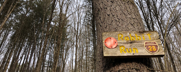
I knew it. No sooner do you have one Rabbit Run course in the Challenge, and then there are two:
Beautiful cloudy morning to run trails! Hoctathon course was in great shape. I pulled into the parking lot around 8 AM and there were already several cars there. More vehicles and people wandering in while I was gearing up. Most crowded I’ve ever seen it when the Thom Bugliosi Trail Run is not happening. Turns out there was a gathering of friends, including members of the Leonard family – young and old, to run at Hammond Hill. I think they all went right at the yellow gate, while I was going left.
The wind had the trees creaking and moaning, which would be spooky during a night run. Many other hikers and dog walkers out and about in the forest throughout the run.
I was going to head back out for a second loop right away, but the rain looked like it would get there before I finished and it looked like it could be heavy. I was more concerned about the wind it might bring and having large branches (ore even trees!) drop on my head. So, I headed off for some other trails, before coming back around 2 PM to run the second loop. The parking lot was empty and I saw no one on the trails until the very end. I did catch a little rain and it was still windy, but some filtered sunlight broke through just before I reached the Blue 3 trail and that held all the way to the car.
Tatyana and I got here ready to run at 7:30 am. There was a large tree down across the trail near the beginning. I was really happy with the trail conditions here, after running in Elmira was like a swamp. However the turn by turn text and audio directions seemed to be having problems. Directions would say right when the map would show left. Happened multiple times especially in the first half. So after that we could not rely on the directions and had to keep checking the map slowing us down significantly and causing us to get confused and end up with significant “bonus miles”. Not ideal for people not familiar with that territory at all.
Reposting becaus eI think I did it wrong the first time. lol
I’m concerned that you may still have the old, corrupt version of the course loaded in RunGo, @Kyle_Reynolds. I’ve renamed the new good version with the word GOOD before the title. Could the next person who runs this with RunGo confirm that they’re using the GOOD version and that it works? Make sure to download it explicitly before leaving home.
Such a beautiful morning and great trail conditions. I did take RunGo very literally so made one u turn right back onto the trail I was on and logged an extra .7 miles backtracking to the correct spot for the u turn.
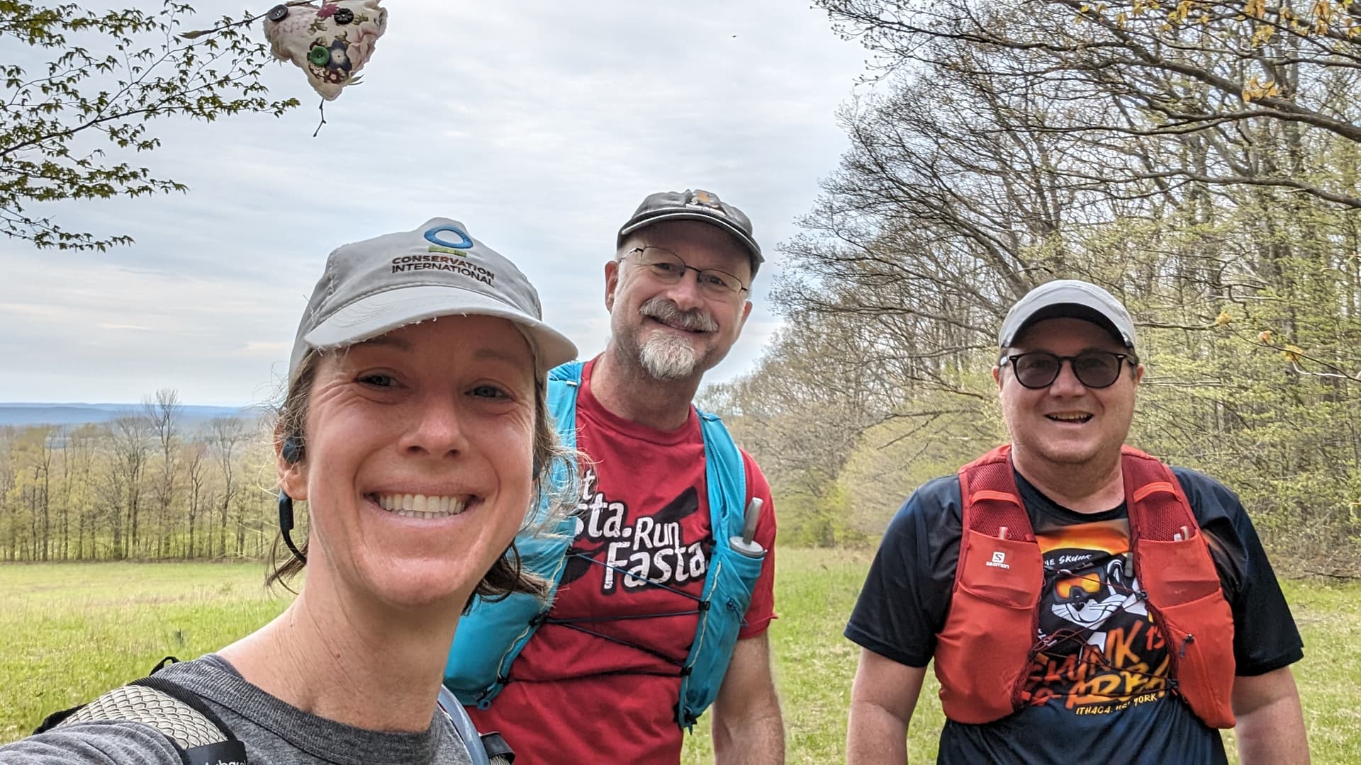
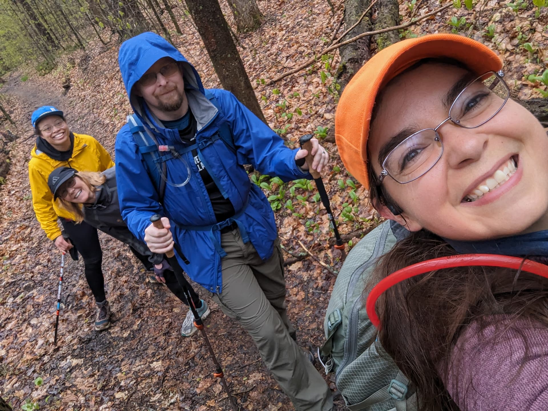
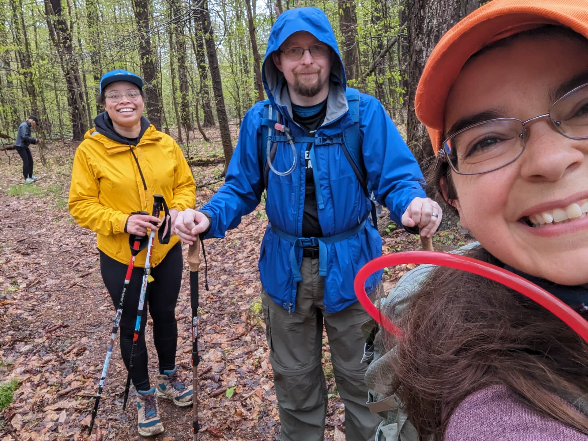
Perfect cool cloudy morning to run some trails with some new friends! Thanks to @heathercobb3 for organizing a group of us and even bigger thanks for the later start time so I could catch up on some sleep first. Enjoyed this rolling but long course by chatting the morning away with @Dirk_Swart and @Gerald. We discussed everything from US environmental policy to bird watching to how much we all like Canada.
Today was a wonderful hike!
Thanks so much @lahelmerick@radicalEdwardIV
For joining us on our hike
It was so wonderful to have such engaging company on this hilly hike
Be sure to post all the lovely pictures you guys took of the various plant life!
Looking forward to our next one! Sorry I had to rush out of there when we finished. Next time we should plan some food!
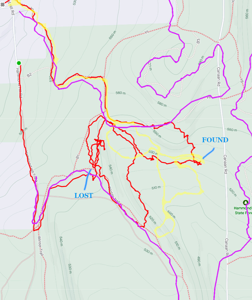
Two weeks ago I decided to do the Hoctathon challenge run with our four-legged companion Maggie. She gets distracted and has run off before, so I kept her on the leash. About 1.5 miles in, I dropped the retractable leash and she was off. I wasn’t initially worried thinking that it would get snagged, so I went through the brush in her direction, but after one minute I could not see her at all.
After ten minutes I was really worried, thinking she would get snagged, so I call my spouse to come and help look. Pretty scary thinking about the consequences.
About one hour later I found her, probably a half-mile away from the last seen location. She was without her halter and leash! Smart girl, and we were obviously greatly relieved, but I was in the dog house for losing her.
So I’ve been back to Hammond Hill twice, trying to locate the lost items which included an Apple AirTag. The AirTag has a distance of about 30-100 feet outdoors. No luck so far.
Attached is my map with the original search (red), last week’s search (yellow), and today’s Hoctathon run (violet). I marked where Maggie was lost and where I eventually found her (or rather she found me). I figure the AirTag battery will last another month or two so I may keep trying.
The AirTag device setting is now set to “lost” so it is possible that someone else at Hammond with a smart phone may get a signal and I could be notified. That would be a hoot.
I don’t want a GPS/cellular dog tracker with monthly subscription, but am going to try to hack together a dog tracker that should work over 1km (using Arduino, LoRaWAN, and GPS). It would be great if I could run with Maggie and she is off-leash, since she would love it more and I’d be a bit less worried about my balance without the leash.
GPS watch started…check. RunGo started…check. Webscorer started… check. Am I ready to start running? Wait…apply some Off!… and phone isn’t in airplane mode… my old battery has died on this course several times before. Ok, maybe now. I know the course well, but will listen to RunGo this morning to check the latest cues. (More on that in another thread.)
Dark clouds in the sky look like rain is coming, so I start with a jacket and light gloves because of the breeze. Midway up the first climb, I stow the gloves. Clearly, @Mr_Hector and his minions have been out marking the Thom Bugliosi course for next weekend. There is so much signage and flagging at the top of the hill by the yellow gate to point out the left turn… but my money is on someone still missing it and continuing down the road!
I hear a woodpecker as I head onto the trail, but I do not see him. I love the descent along the red snowmobile trail to Canaan Road! It’s not steep and I actually feel fast today on that stretch. The spring time grasses on the double track (and single track) are brushing me knee-high in places – happy to have remembered the tick repellent. I am overwhelmed by the vivid green of the trail today. The leaves on everything are brightly popping and there are numerous wildflowers! Somewhere around mile 5, I think, when I was on a section that overlaps the Thom B course, there was a bit of sunshine and the trail was lined on both sides with hundreds of trilliums! Magnificent!
I ran Hoctathon this morning using the GOOO marked version. There is one main point of confusion in the RunGo cues: At the right turn onto the red snowmobile trail just past one mile, directions correctly say to go right on the red trail. But the cue also says this is still the blue trail. That part is incorrect. The blue trail actually continues to the left at that junction.
I found the cues were quite accurate, including mile 1, 3, 4, 5, 6, 7, and 8 distance cues, except for the first section of Y8 after turning onto it from Y7. The cue about taking the left to avoid the little loop to the right came at mile 2.8 on my watch but I had passed that point at mile 2.6. This cue is a bit confusing anyway. The blazed trail is the little loop to the right. The left trail entry has branches across it to indicate the wrong way but the left trail does go alongside the small stone foundation there. Not a big deal as both merge together again. Note that the 3 mile cue from RunGo after this was spot on. Cue that I had reached the top of the climb was also spot on.