My friend had the idea that one of us start at Taughannock, one at Cass Park, swap car keys when you pass one another, then drive the other’s vehicle to meet at the Glenwood Pines.
Aren’t the Dawsons (@amy-dawson@scottpdawson ) friends with everyone?! They could start at the park end and do a key swap with all of the challengers?!? This sounds like a reasonable ‘challenge’ for the Dawsons!
A less-paved option is parking on Juniper (near where the 2021 Challenge sign was located) and run about 0.4 miles of asphalt up to the orange-blazed singletrack trail for a lollipop loop. 5.0 mi Run Activity on October 23, 2022 by Pete K. on Strava But Adam mentioned earlier that IC has been difficult to deal with re permitting.
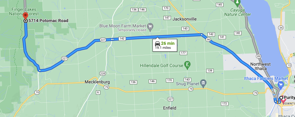
I like this loop. It allows people to experience the best parts of the FL50s loop without commiting to the whole thing. It could also start on the road near the Potomoc Group Campground (where FL50s starts), which makes for easy access to the campground’s toilets at the start and finish.
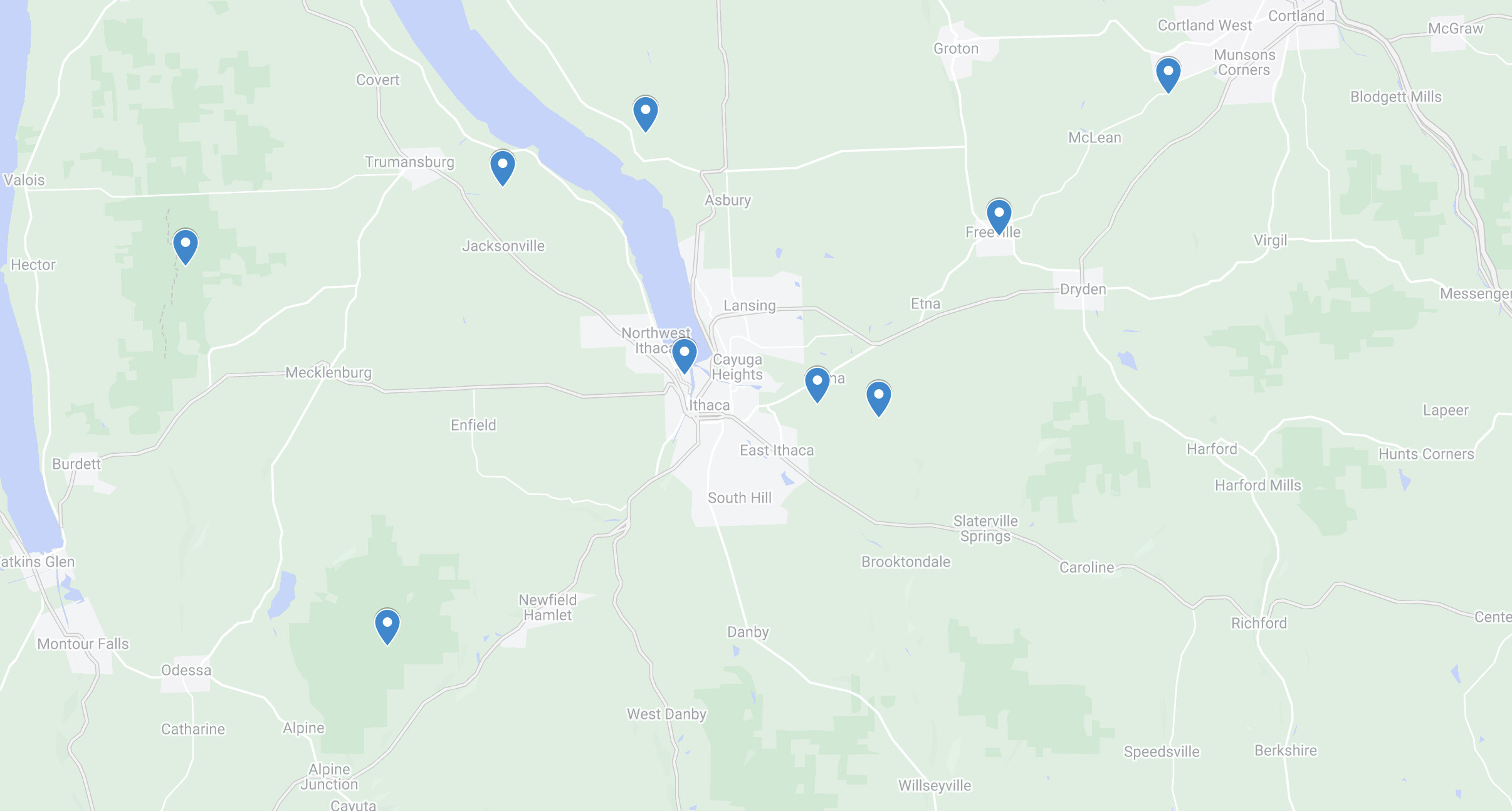
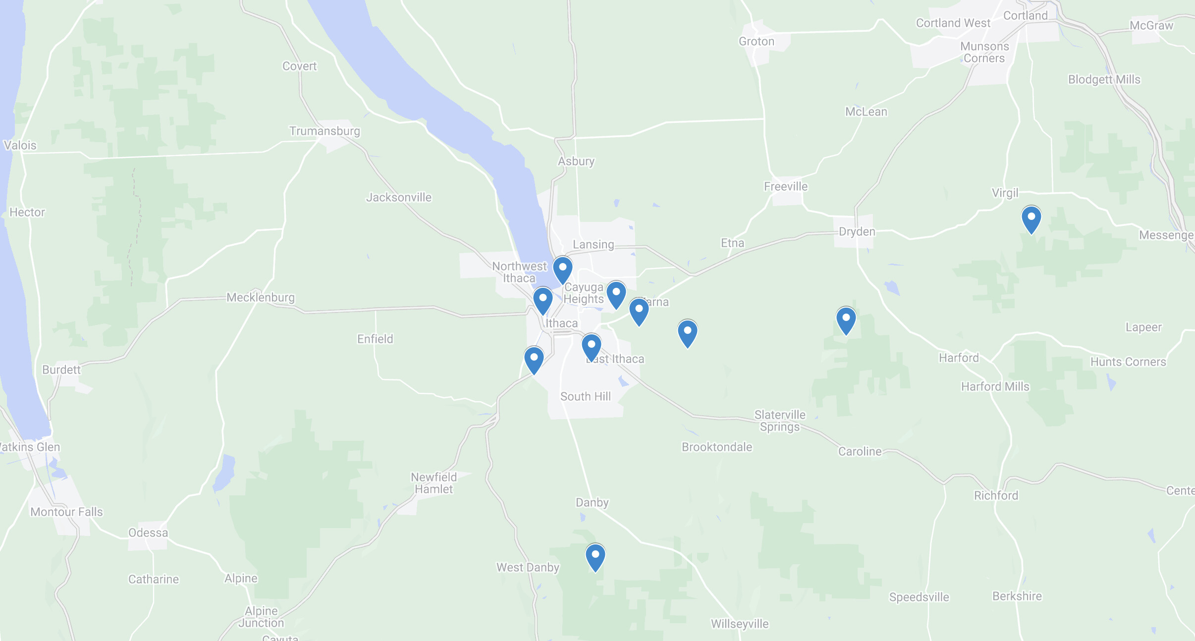
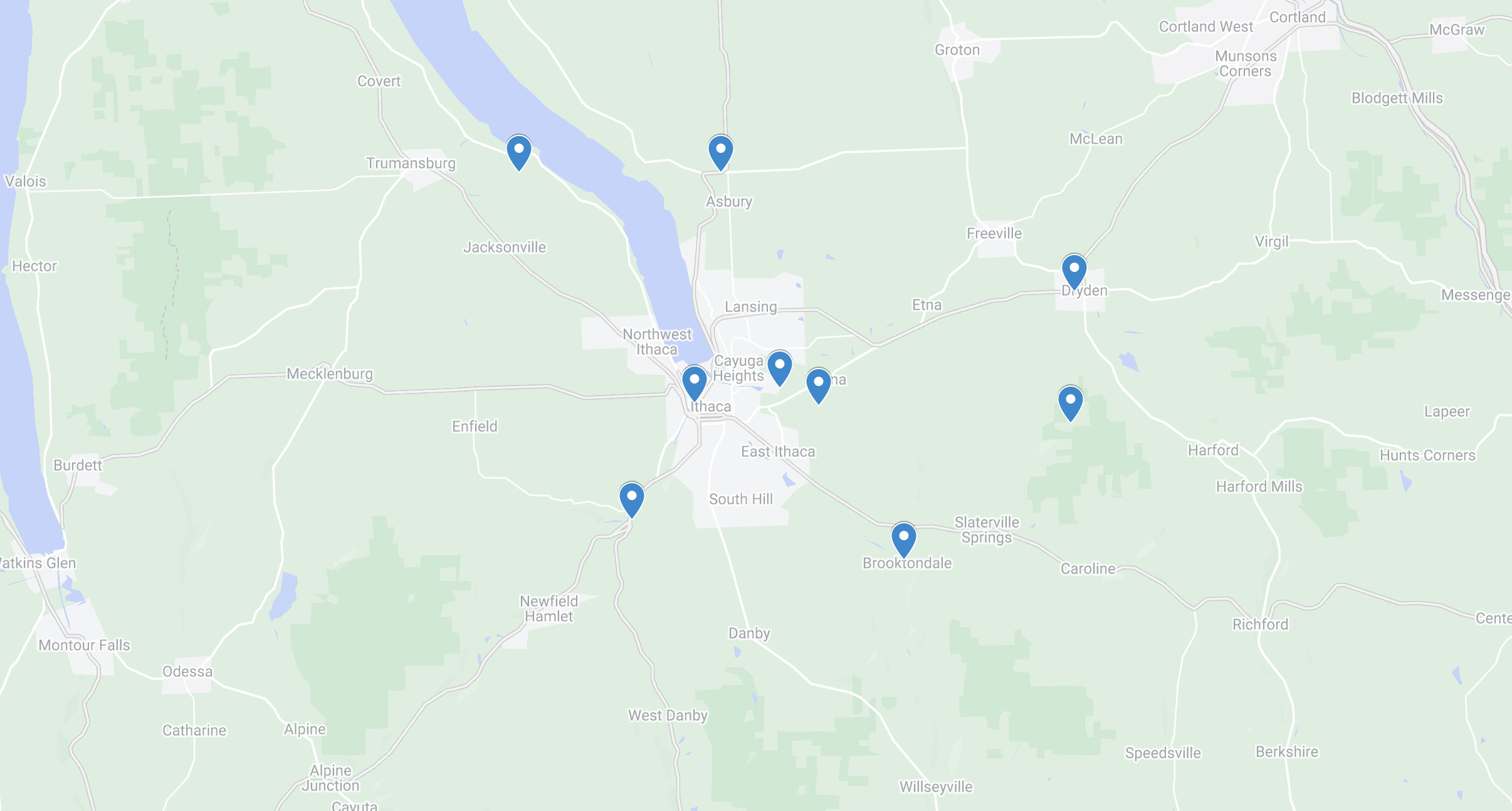
Keep those course maps coming, folks. Right now, it’s feeling overly weighted toward the western side of the map with CT Hill and FLNF; 6 Mile Creek or Ithaca College might bring things more into balance. And it’s really spread out, with a lot more of the courses further out. I’m not wild about that—it will cut down on engagement if there’s always a significant drive involved.
When mapped out, it looks like we need to stick to either west or east on these courses with long drives and possibly limit the number of distant courses?? If the challenge continues for more years, you could alternate east and west.
Personally, I don’t think the drive is that bad between the courses on the west side, but I live practically in the middle of the 3.
The logistics of the Ultra and the BDT are interesting. Will you allow out and back, cover the distance for that course?
Yep, for the Ultra Challenge, people can run it any which way makes sense. For individuals, that would probably be an out-and-back, but I could imagine someone having a driver such that they could run it one direction or the other.
If we want some trail courses closer to Ithaca, what about Monkey Run? I’d suggest Sapsucker Woods (selfishly, because I live close by), but I’d guess they wouldn’t want to encourage too many people running there and disturbing the birders.
Alas, Cornell Botanic Gardens explicitly said we couldn’t use Monkey Run because the trails are in a precarious condition and they don’t want more people using them.
I wouldn’t even consider asking the Lab of O about Sapsucker Woods because of the birders. Occasional runners aren’t an issue, I’m sure, but no need to push our luck and risk getting banned.
I’m a little late to the discussion but I love the idea of an Abbot Loop run. And I think 8 miles is a reasonable distance, giving the trail runners something to sink their teeth into, while still being somewhat manageable for those who are more comfortable on roads. That said, I respect that @Petorius has very different perspective and knows those trails pretty well. What if we included it (it is well maintained afterall) but encouraged more road-running Challengers to hike parts of it, if that helped them feel more comfortable?
I also really like your suggestion of adding back in the Black Diamond trail, with the option to run the entire length and back, or just halfway and back, and from either direction. So much flexibility here.
I think the Ultra Challenge has to stick with its 24-hour cutoff, but yes, any given year could be easier or harder in terms of elapsed time depending on how far apart the courses are. Just another variable to add to the challenge!
With all the extra driving required in between these courses, if there are multiple attempts made that land just beyond the 24 hour cutoff, it might be something to keep in mind. Meaning, only the fastest runners could potentially be able to make the cutoff because mid-pack runners driving speeding between the courses to make up time doesn’t seem wise. We’ll just need to see how it goes with the first to attempt the Ultra Challenge. I am raising this concern but do recognize that it may not become an issue.
Looks good, @SarahG, and it seems like a reasonable loop. Perhaps folks who live out that way like @Banyan_Tree and @Mikhail_Kern can run this and compare against the Connecticut Hill course that @gplwoo posted.
Yep! Honestly, although I think the Ultra Challenge attempts would potentially run afoul of courses that are too far apart, I’m more concerned with the overall effect on the Challenge as a whole. It’s fun to have a course or three that take people out of their usual haunts, but having too many spread out would have the effect of focusing most runs on the close-in courses, leaving the far-away ones for one-and-done, which isn’t really the goal.
I may try to establish a driving time metric from somewhere downtown and see how the different years compare. I may also be able to pull some address information (like from the lawn signs) to find out where the bulk of Challenge runners have been located in past years. Rough data, for sure, but it might reveal some patterns.