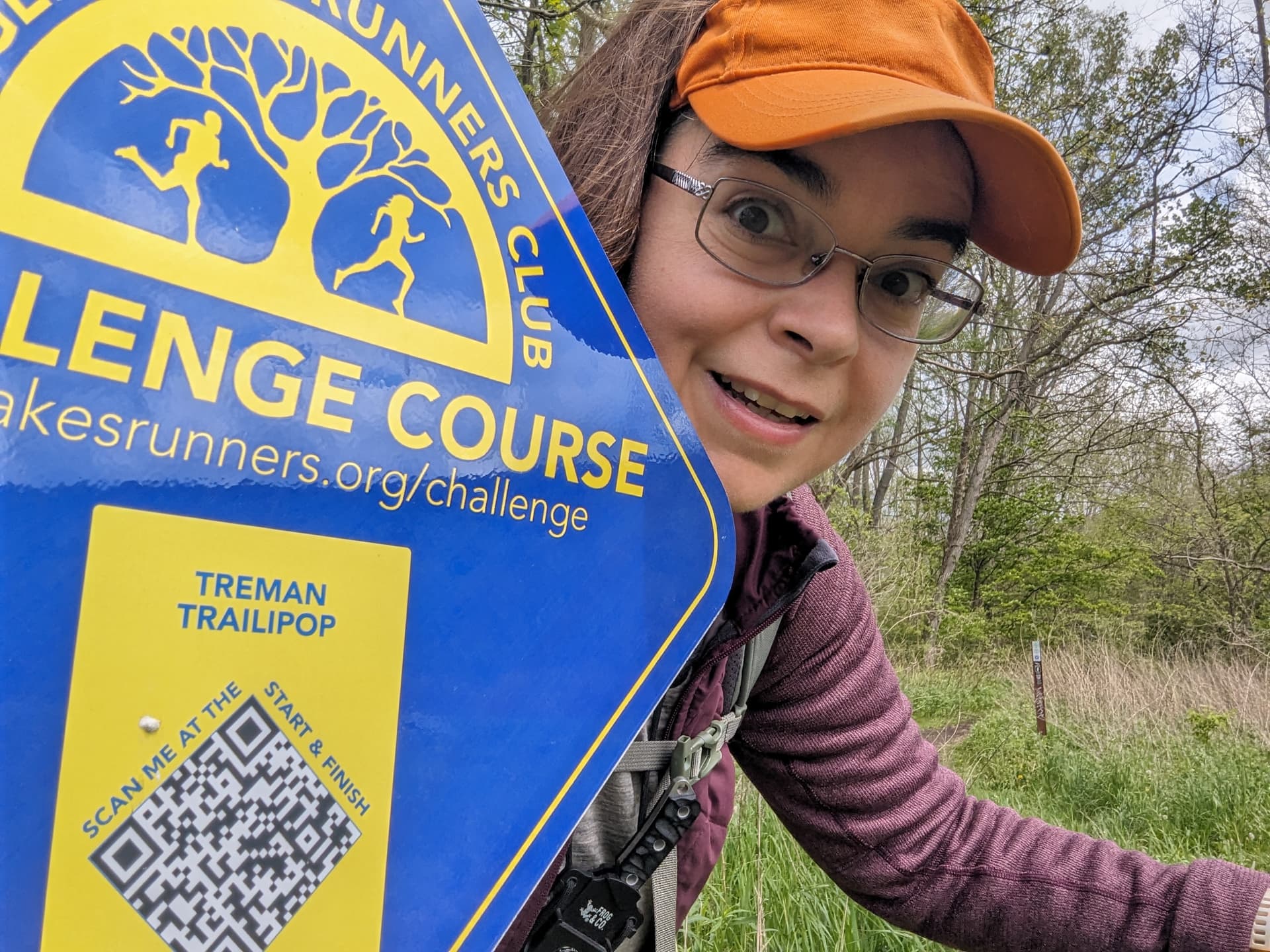
Use this topic for posts to collect community stars for the Treman Trailipop course.
Here’s how it works.
Click the “Post Using This Template” button below to create a new post with a Story heading and boilerplate text.
Replace the boilerplate text with your report for one or both sections. The header is key for distinguishing between posts and replies—don’t change it.
Your post must be on the same calendar day as your run as entered in Webscorer.
Story
To pick up a community star, replace this text with a write-up of what your run was like, a photo you took on the run, a link to your Strava track, or something similar. Don’t delete the Story heading above.
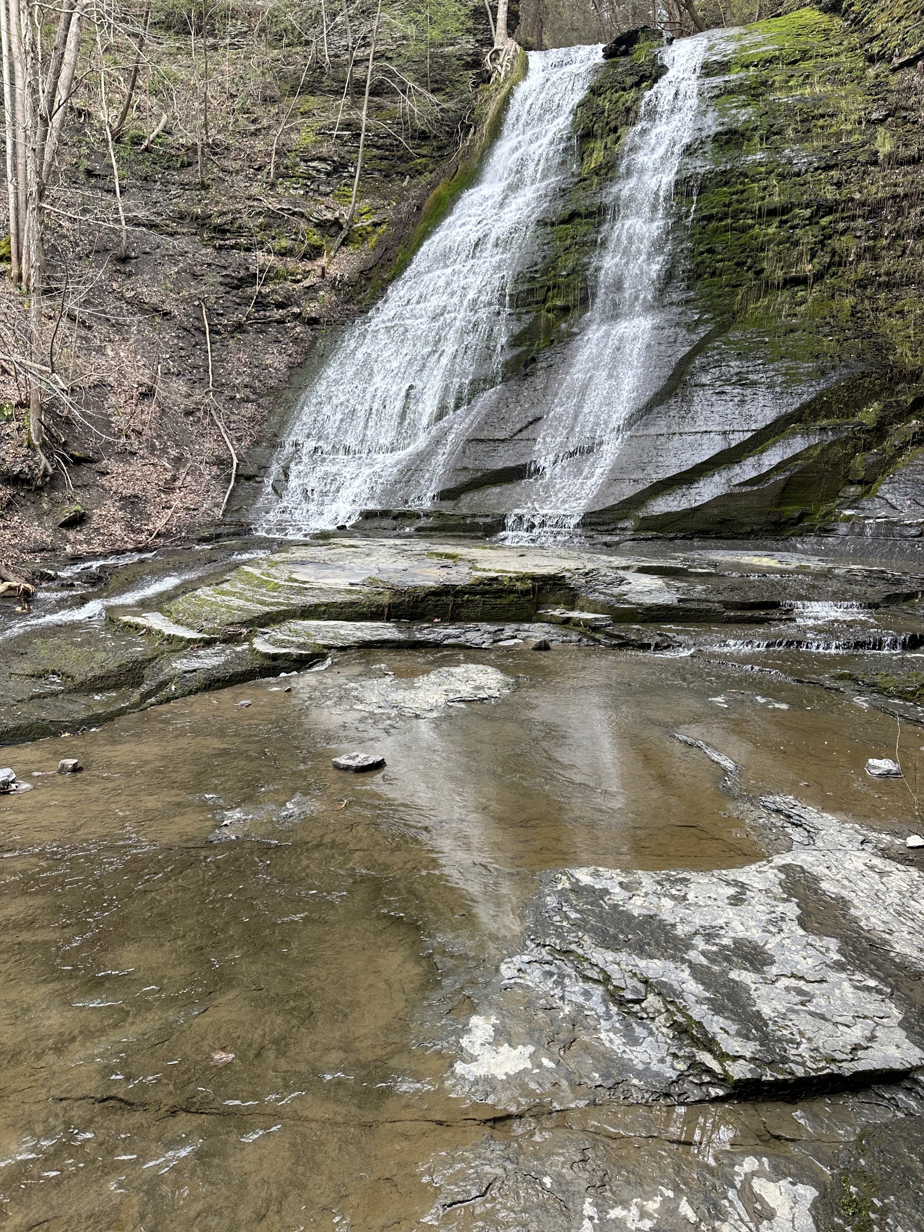
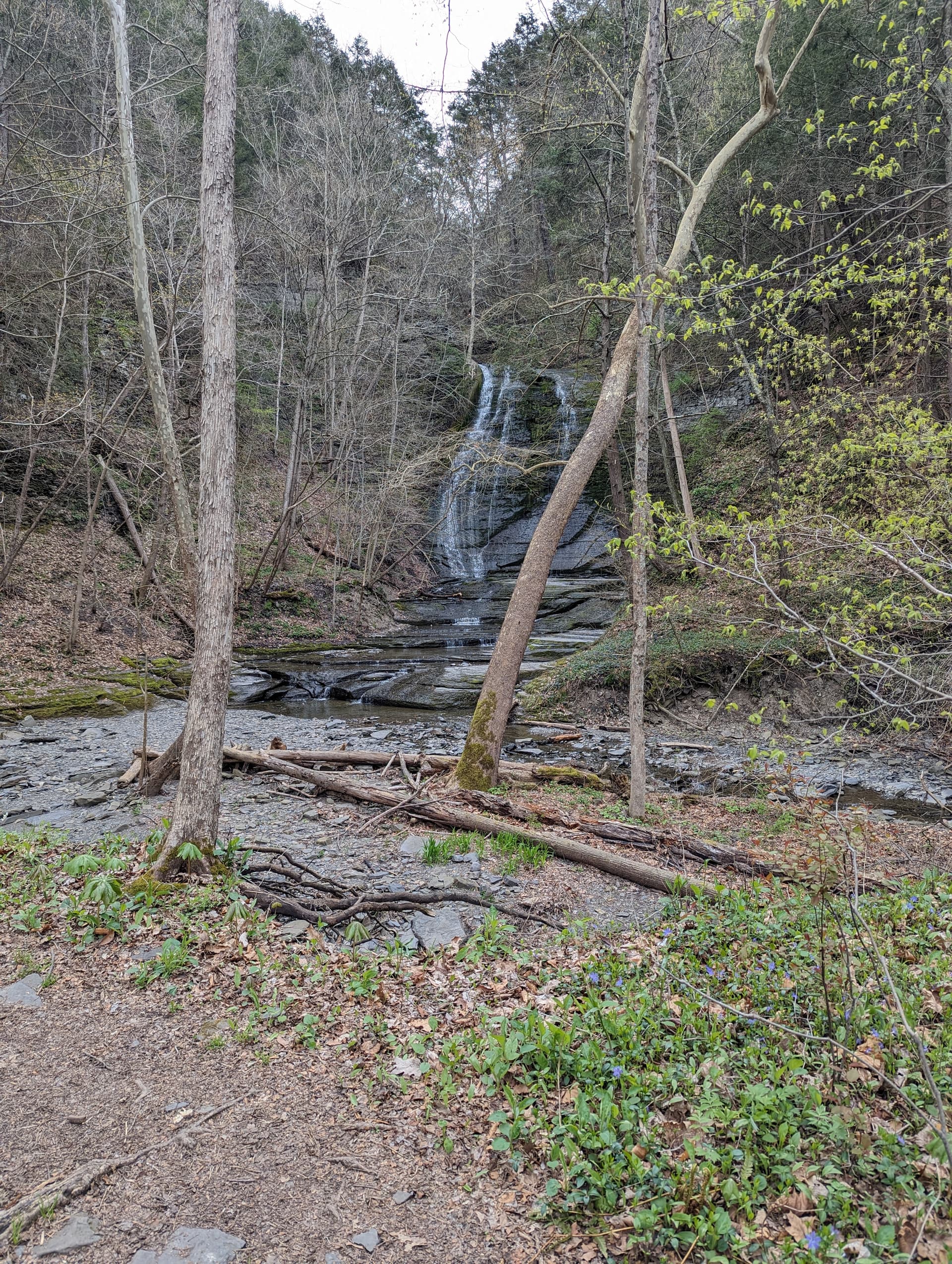
Didn’t actually run the course but I wanted to stop here to see if Lick Brook was running because I never manage to actually see the falls with any water.
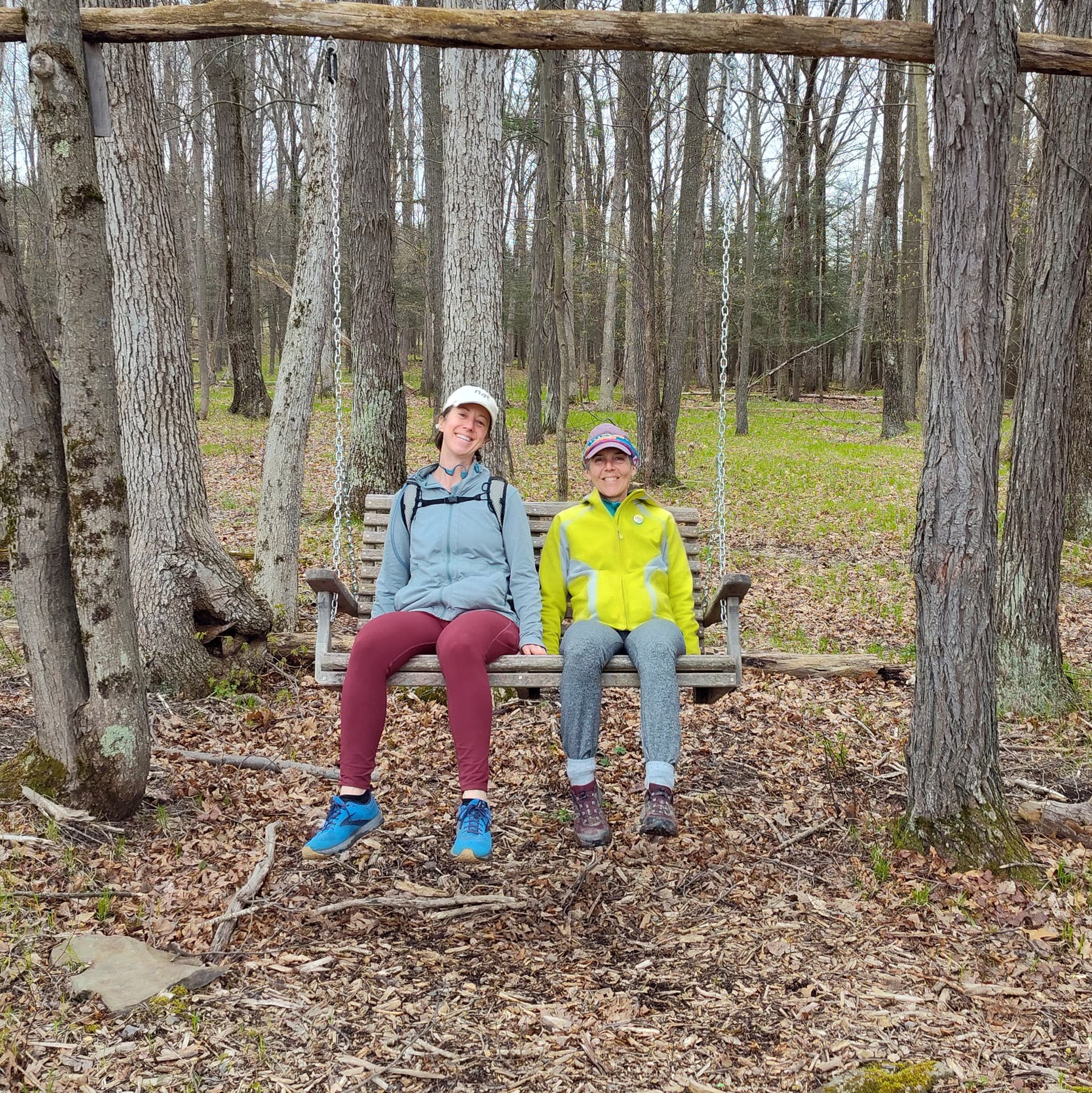
With the FLRC challenge director’s blessing, I started my challenge on April 7 (just after Skunk Cabbage) so that I could finish all the courses before I relocate to Edinburgh, Scotland next week. I ran this one by myself on Friday afternoon after my last day of work at Cornell.
On this one I previewed the RunGo directions before heading out, but I did not preview the driving directions to the start and so I automatically turned off Route 13 at the sign for Treman. That took me on a little tour of some farmland that was not near the start at all before I got back out to the road and found my way to the actual parking area.
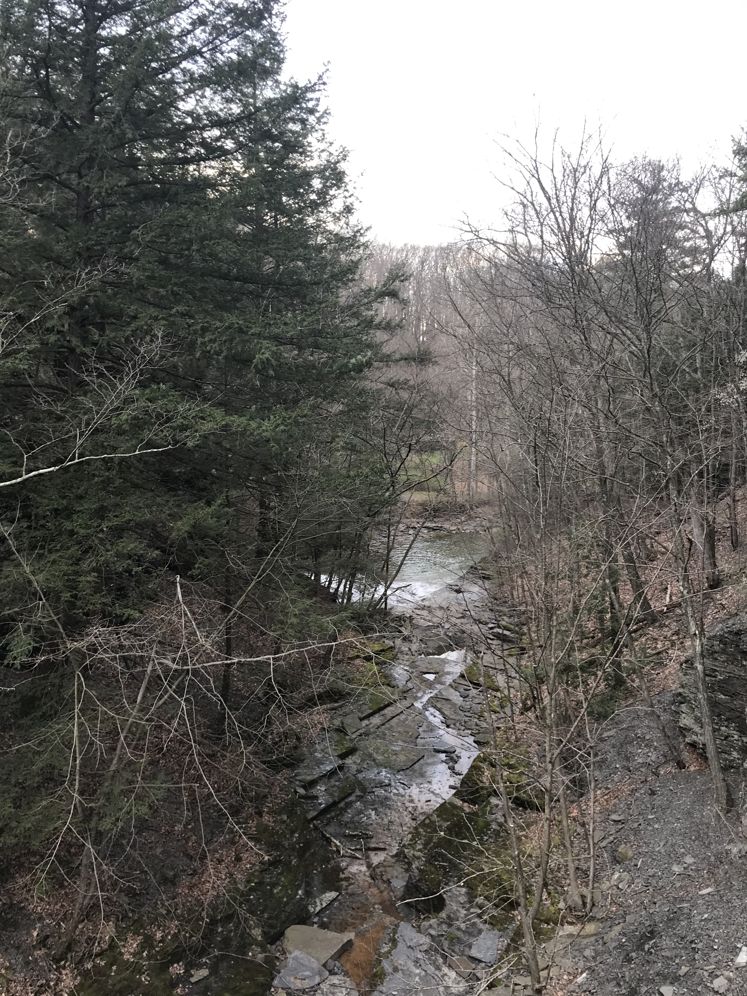
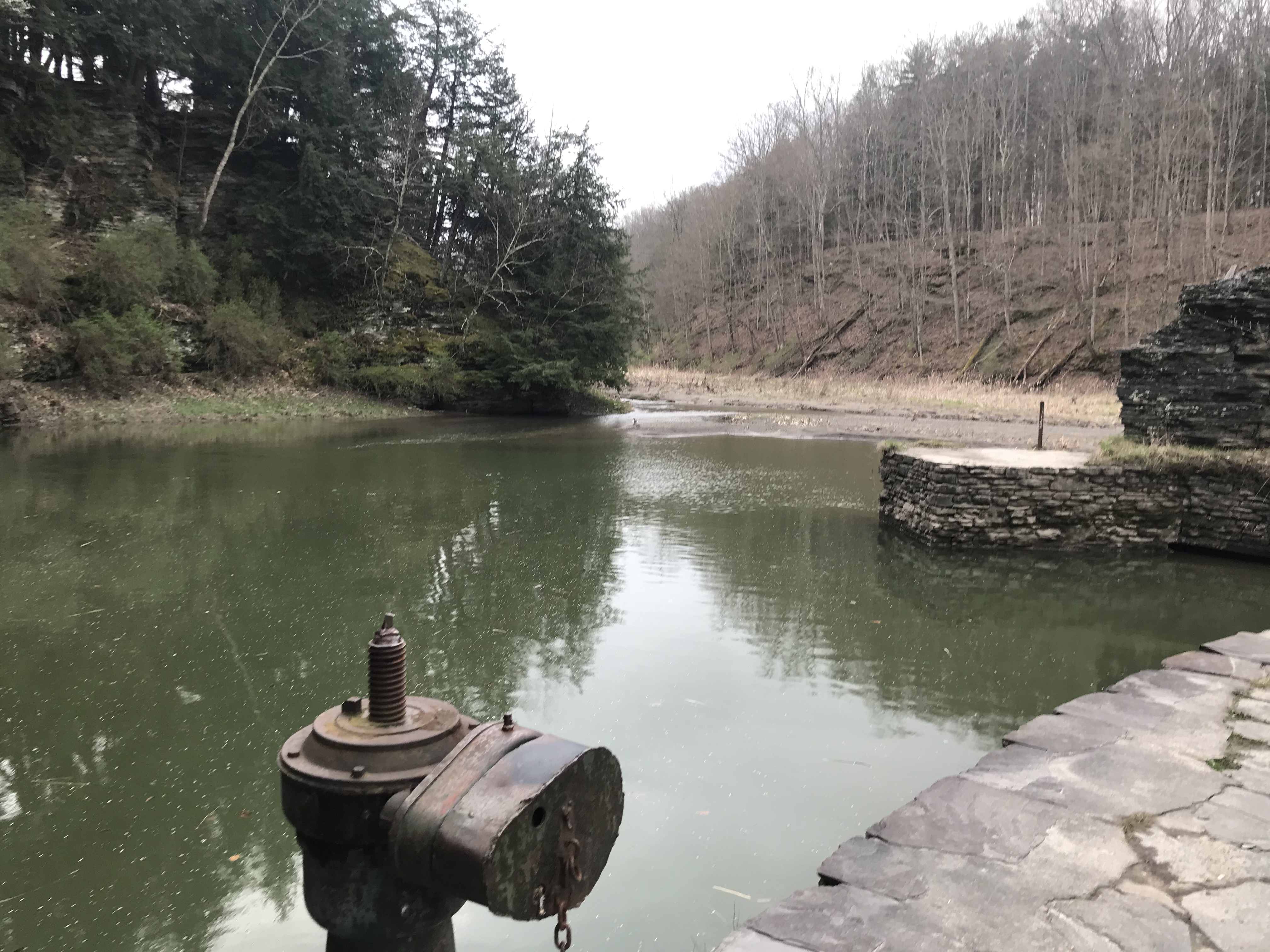
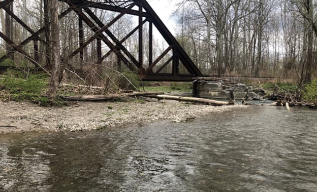
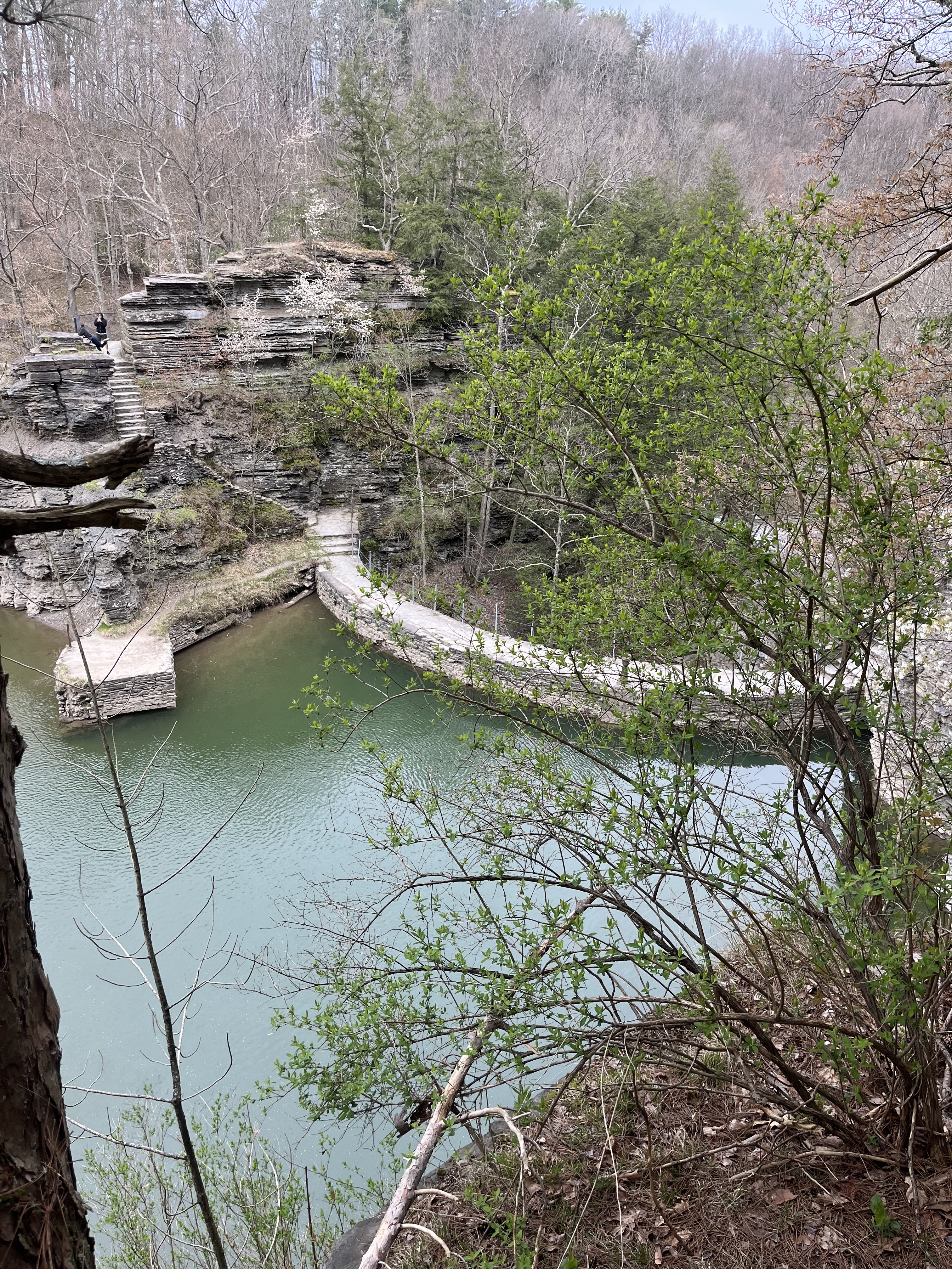
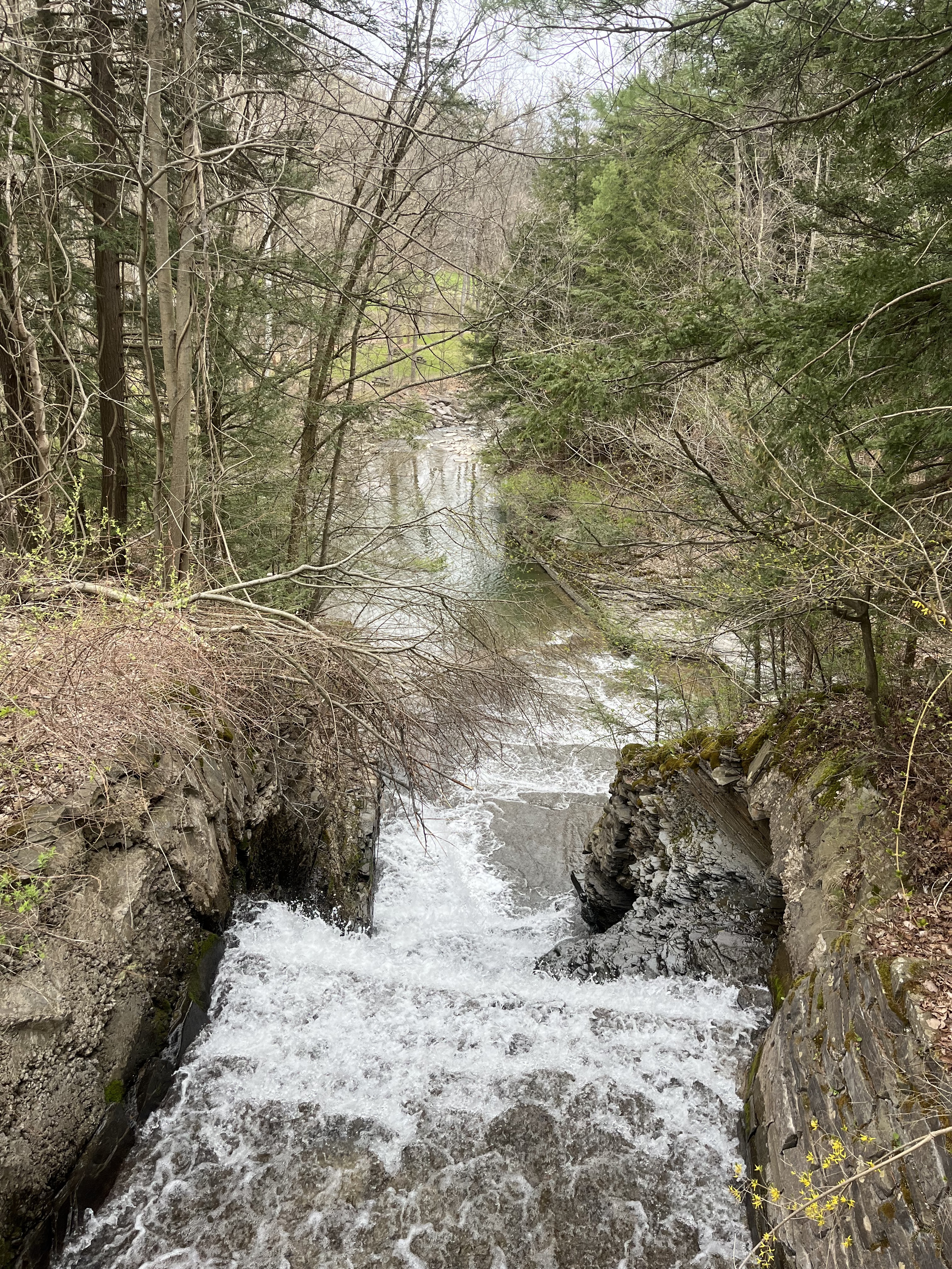
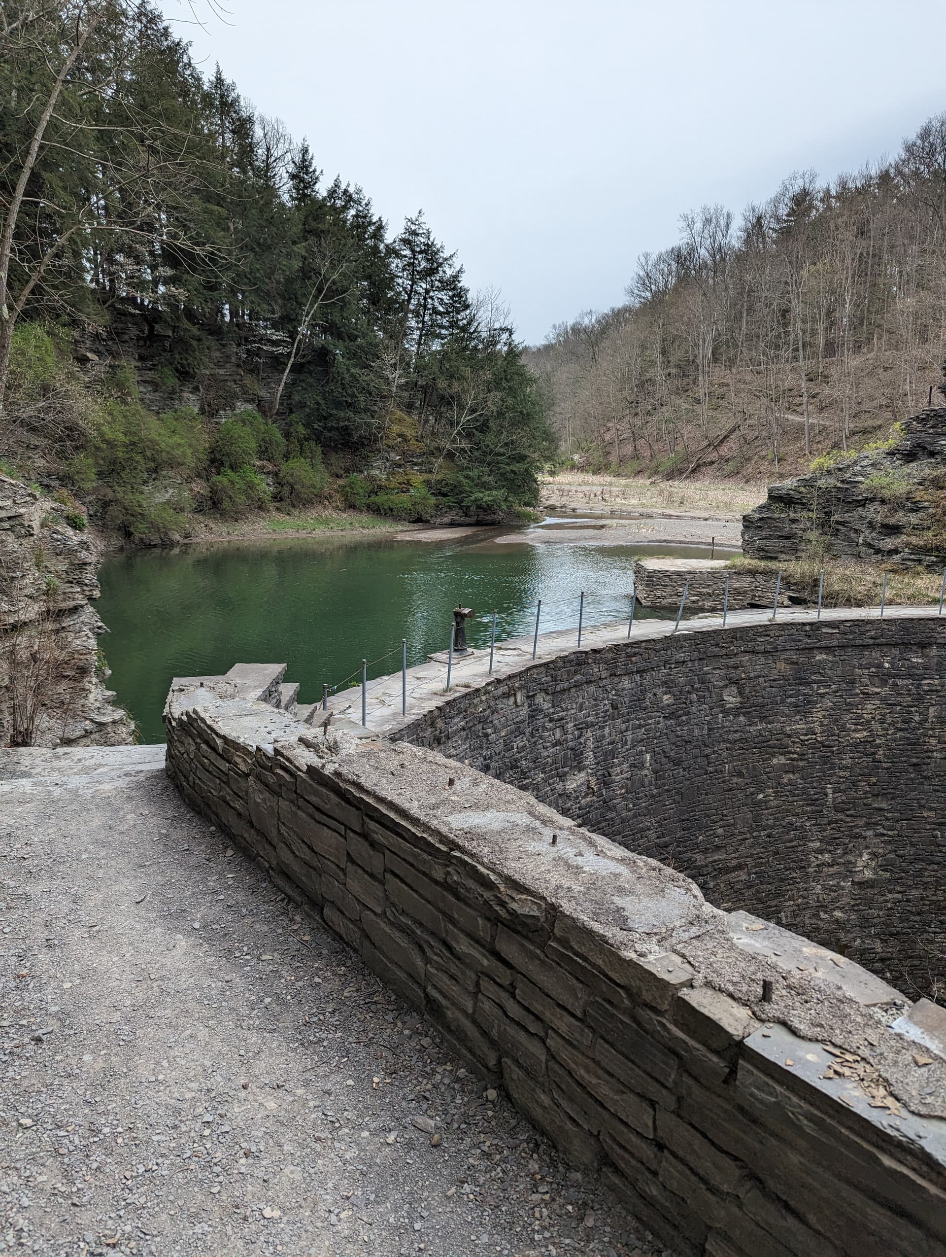
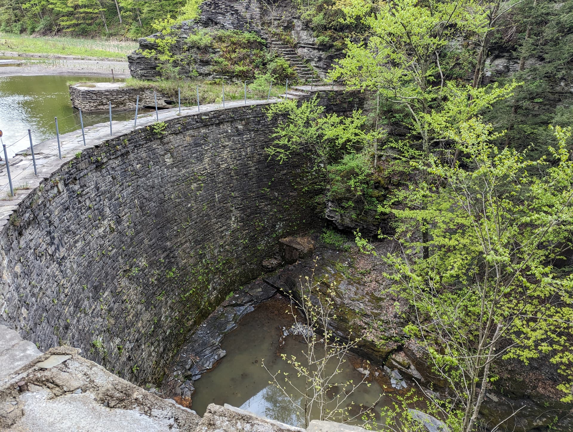
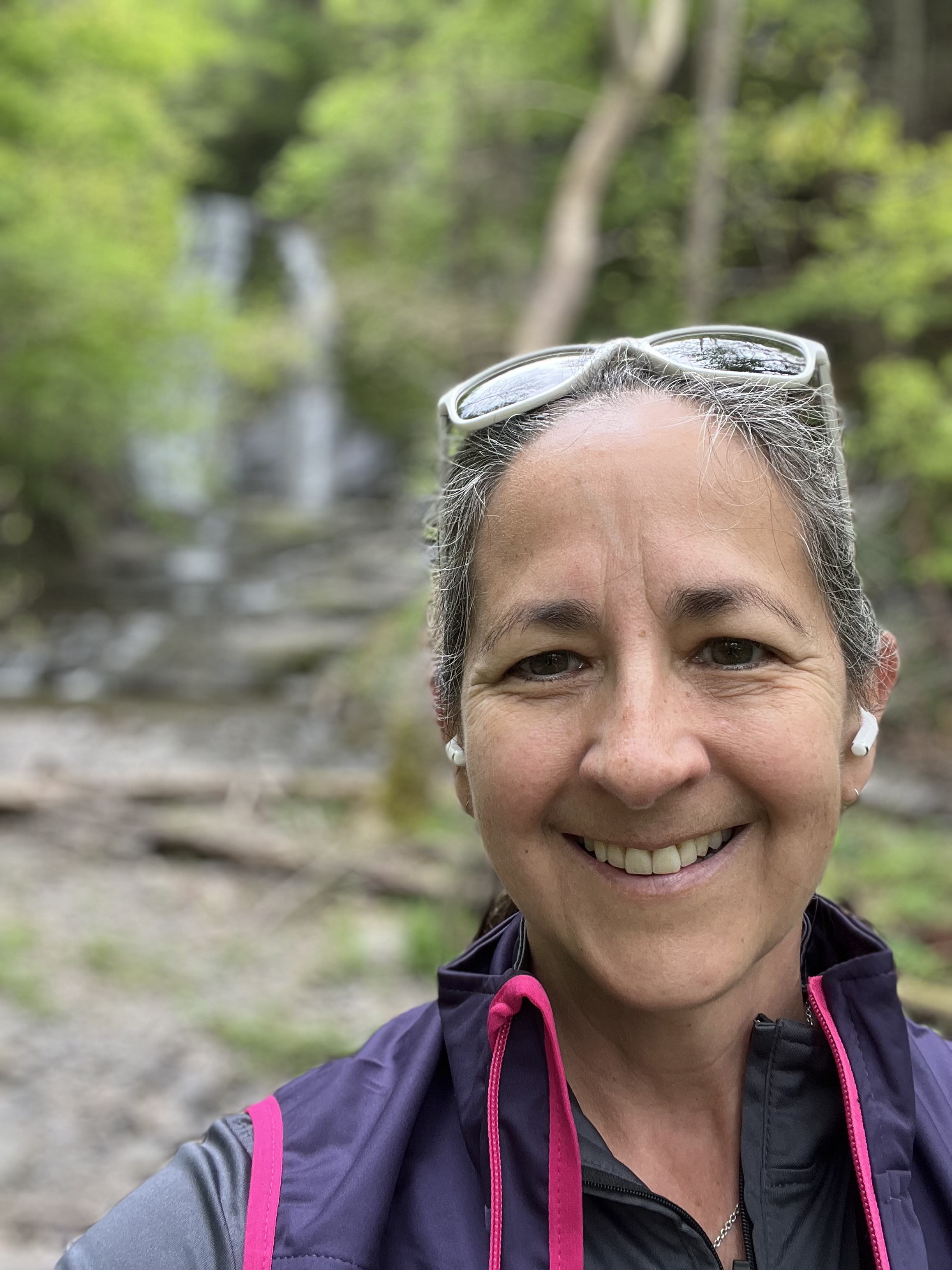
Conditions were muddy right off the bat in the field/meadow-like area before the railroad bridge. The trail dried out a lot as it began to climb, but then you’re climbing some pretty serious grades and knowing that I had the Hoctathon today (and a cold), I chose to walk them. It was a good decision as I felt full of energy getting onto the flatter singletrack areas as you approach South Hill Cider and enjoyed running through that part and onto the road section. I also had a blast on the lake trail, where I hadn’t been since I moved to Ithaca in the middle of the 2021 challenge, and took these pics from the bridge:
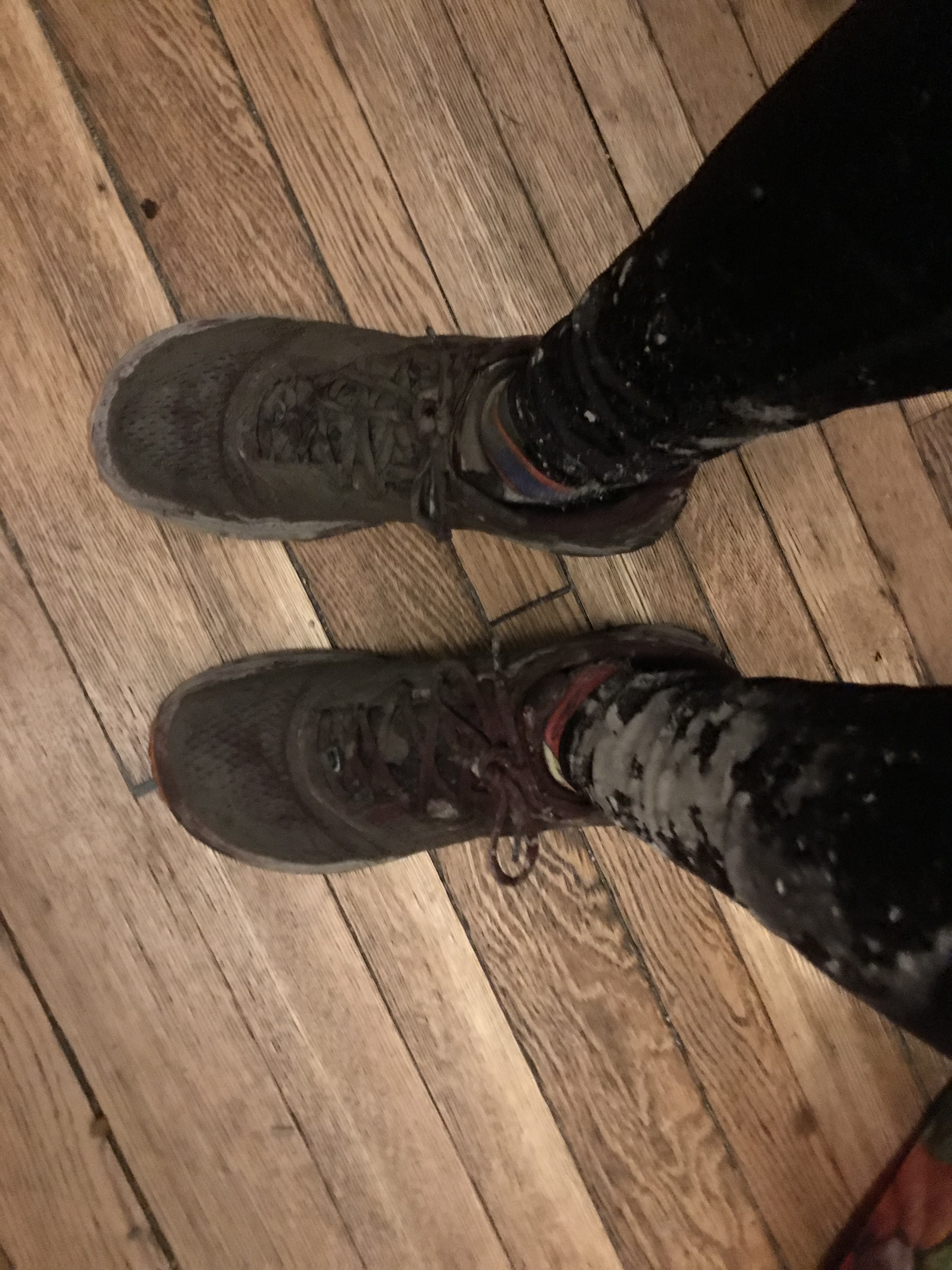
Things were uneventful throughout the way back, but there was quite a bit of mud on the field section near South Hill and again at the very end. I headed to Wegman’s after the run and got a few odd looks because this was the state of my leggings and shoes:
This course is about a mile and a half from my house so I decided to jog there. I felt some pep in my step on the way and a planned easy run became a harder effort.
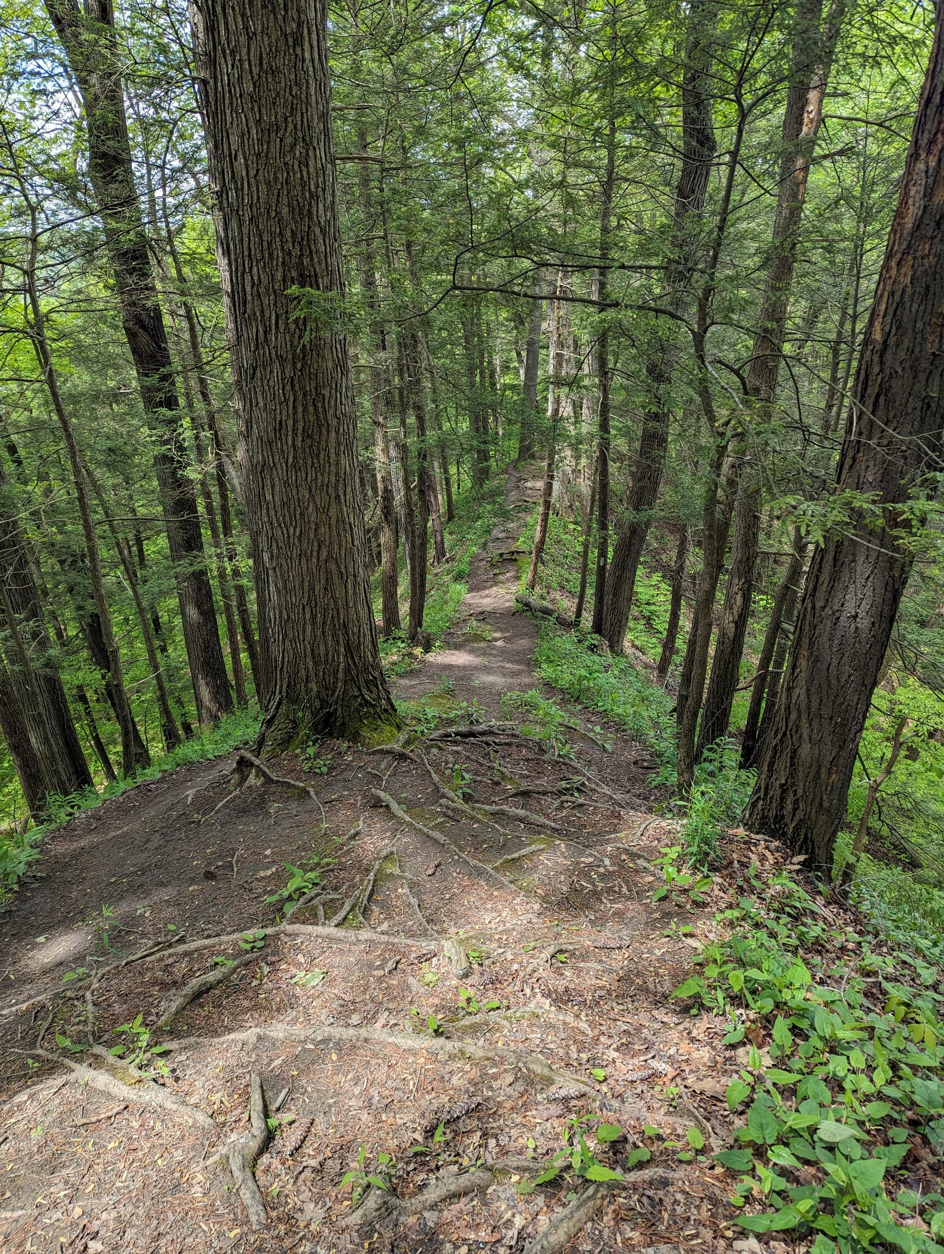
I started in the middle on King Road and opted to run the Lick Brook leg first. Going down was easy enough. Navigating the roots, rocks, trees, and turns kept me from going fast enough to get tired. Once I hit the bottom I was able to pick up the pace and enjoy the flat, smooth trails out to the canonical start/finish. I tapped the sign and made my way back.
Then came the hard part. Normally I am a big fan of running 200 meters, but I strongly prefer to traverse it horizontally rather than vertically. Oh well. My quads and glutes were protesting greatly by the time I crossed Town Line Road, and I still had to do some more climbing to get back to King Road.
Eventually I made it off the trails and onto my preferred surface. I thought of Joni Mitchell’s aptly-titled “Refuge of the Roads” (in which she sings “I was running like a white-assed deer”). By this point I was running much slower than a white-assed deer, but I knew I only had to do a loop around Lake Treman so I soldiered on.
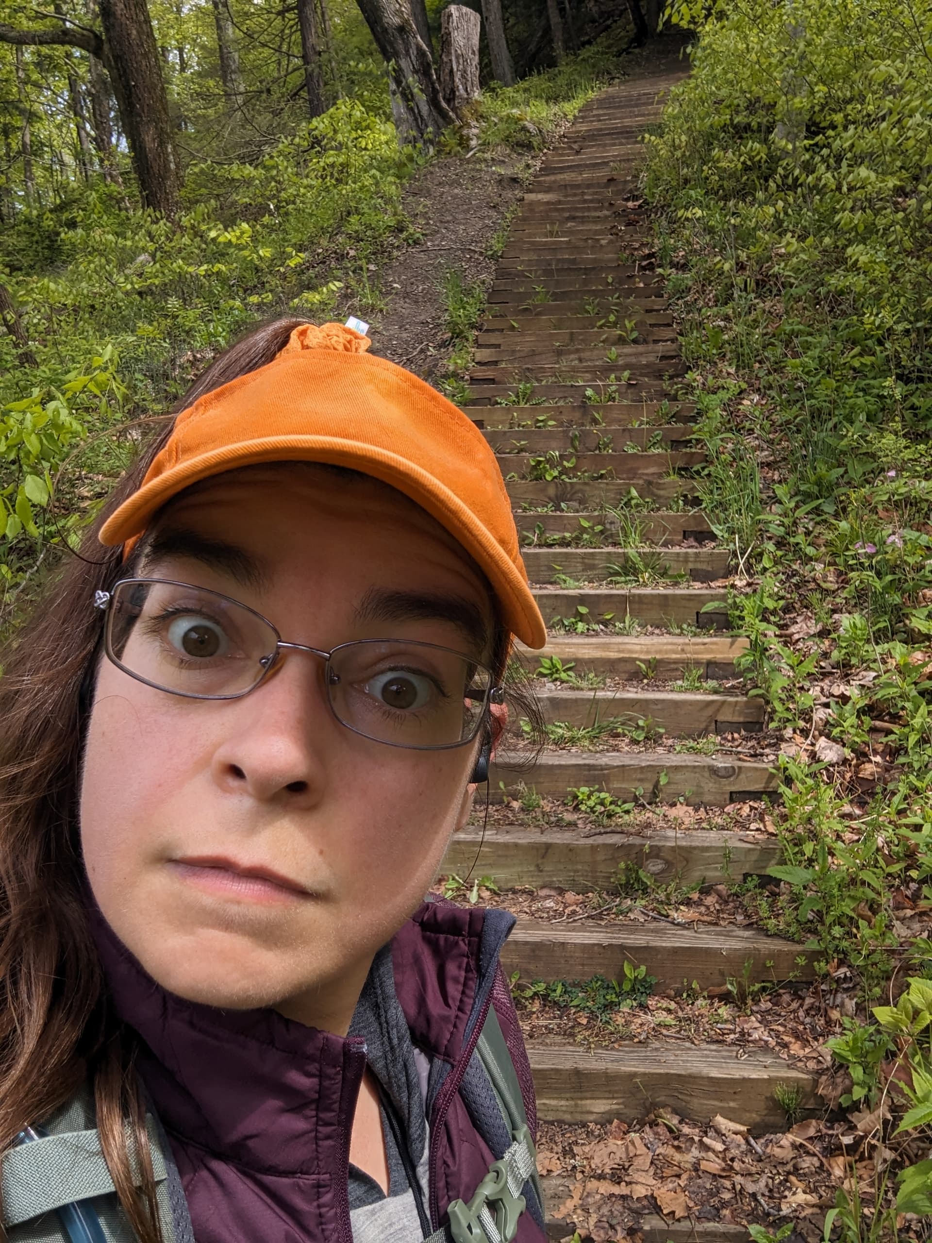
Somehow there where a lot more stairs on the east side of the lake than I remembered. I walked up the longest set and ran the others. The west side of the lake was more forgiving, but I did have to stop to climb under and over some fallen trees. After that it was back to the refuge of Yaple Road and a final hill, although it barely felt like a hill at all compared to the rest of the course.
Trailipop… -sicle, -tart, …
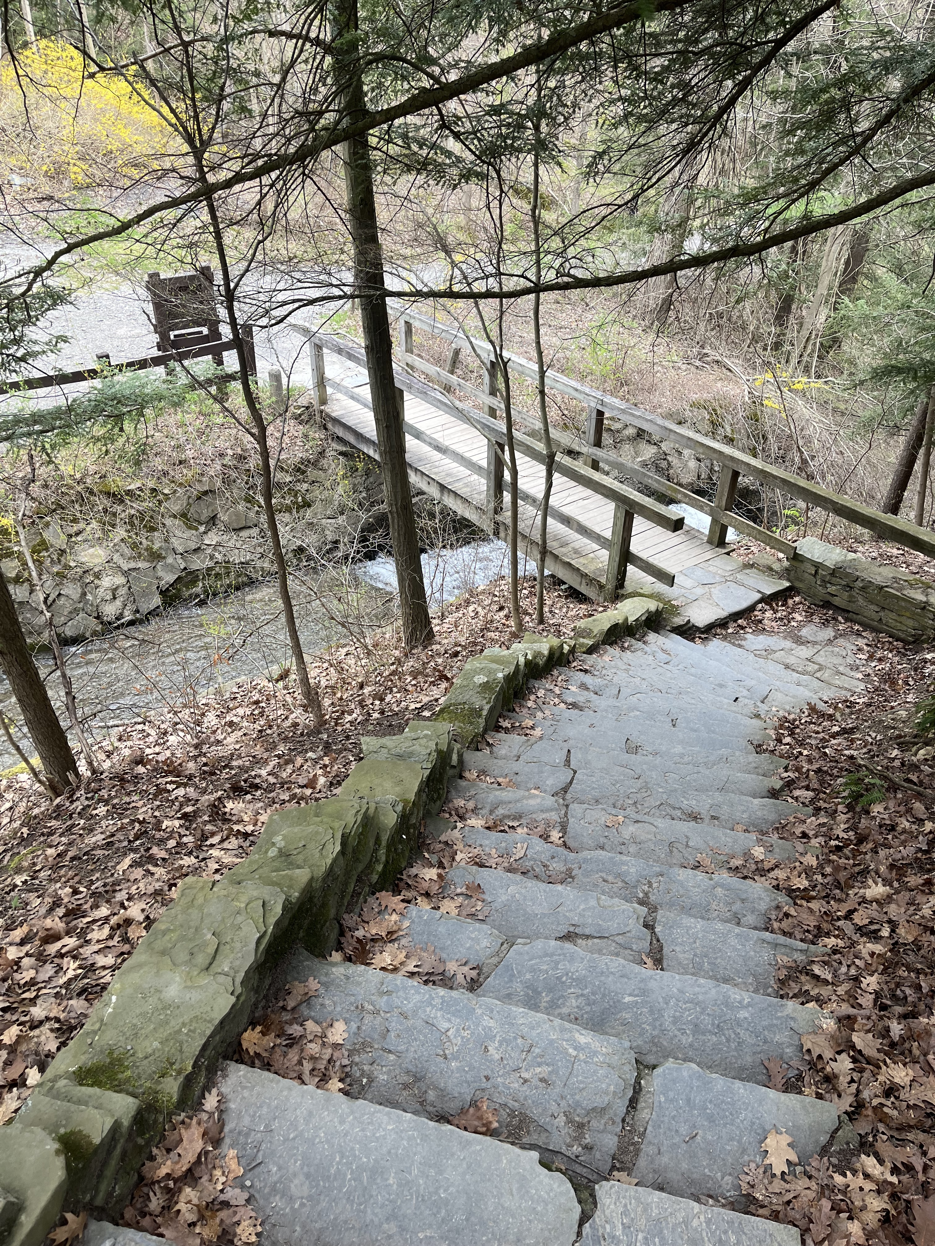
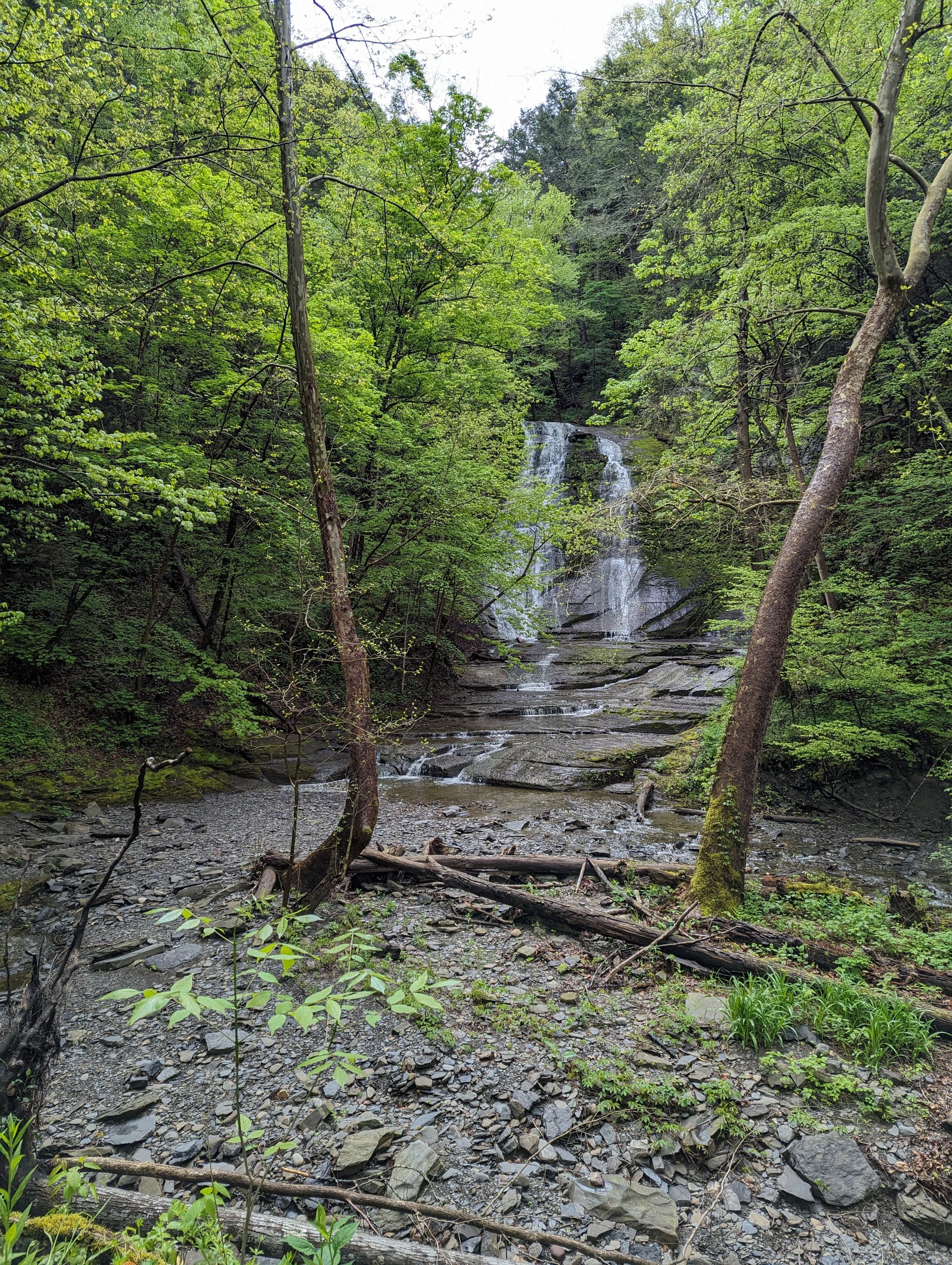
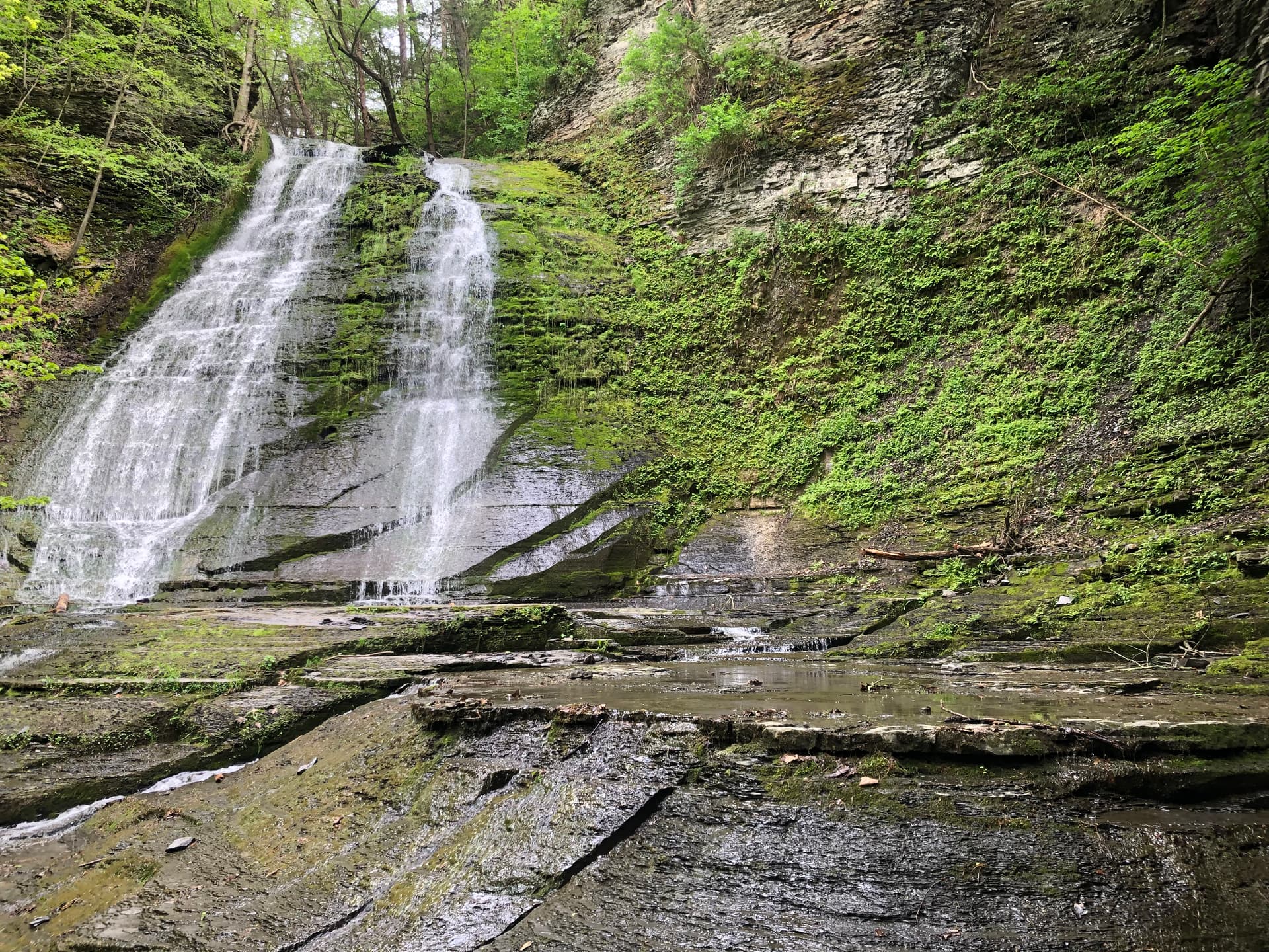
Either way, this is a great-tasting course. ‘Popped’ in here next. For the first and maybe the last time, I used the railroad bridge to cross the creek. Lick Brook Falls were as pretty as I’ve ever seen them and much better than the nothing of last year. I’ll forego a photo, since I think it’s been posted already. Mostly barren trees afford nice views of the many falls along the trail right now.
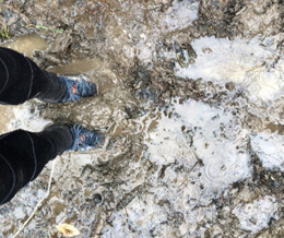
Upon reaching W. King Road, I decided to accommodate today’s pair of trail shoes and turn right to take the optional trail course to upper Buttermilk. Today’s pair has been jealous of it two brother pairs, which have been caked with mud for weeks. By the normal standards for this section, it wasn’t too muddy and wet:
Feet are bound to get wet anyway, so might as well enjoy it!
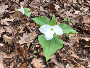
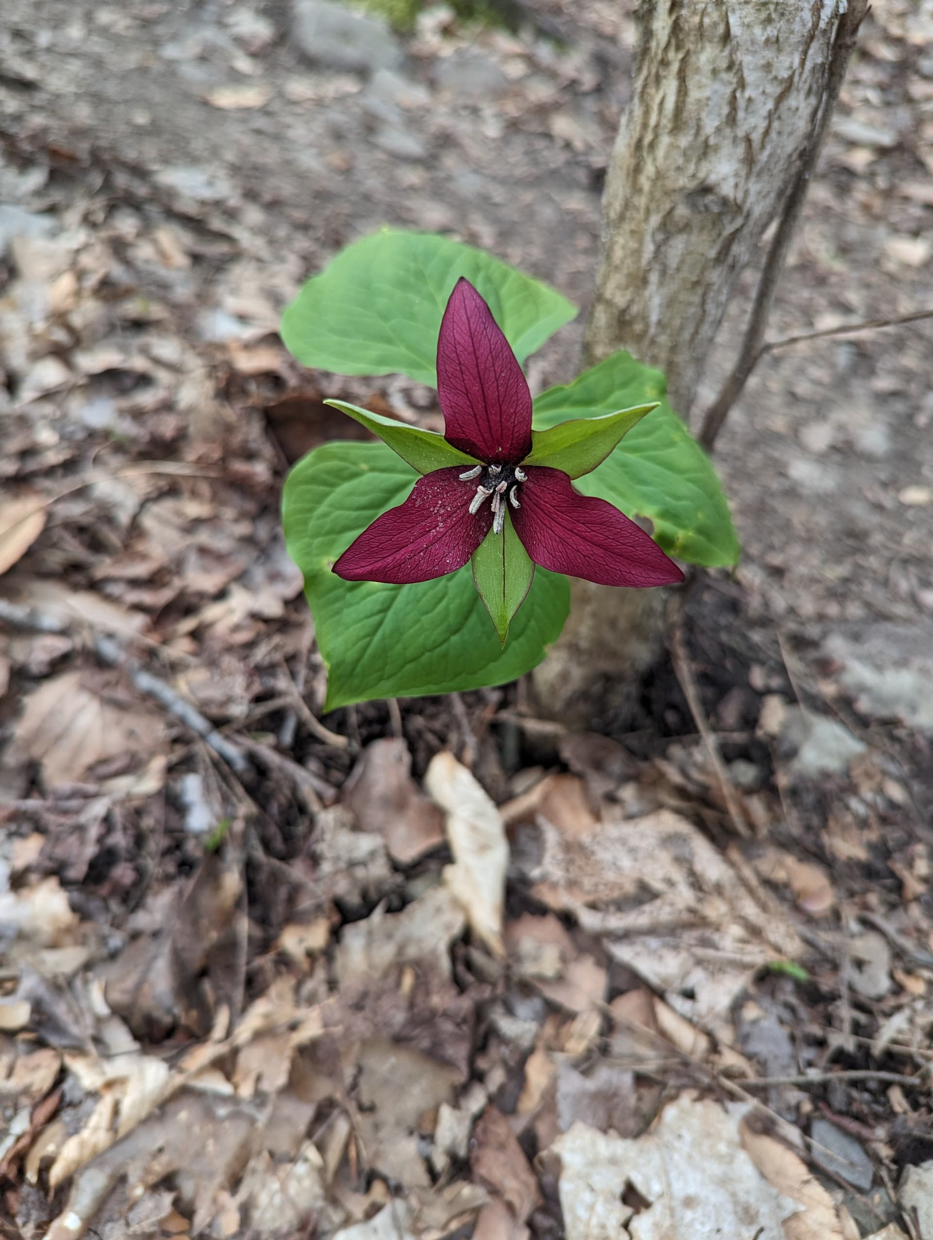
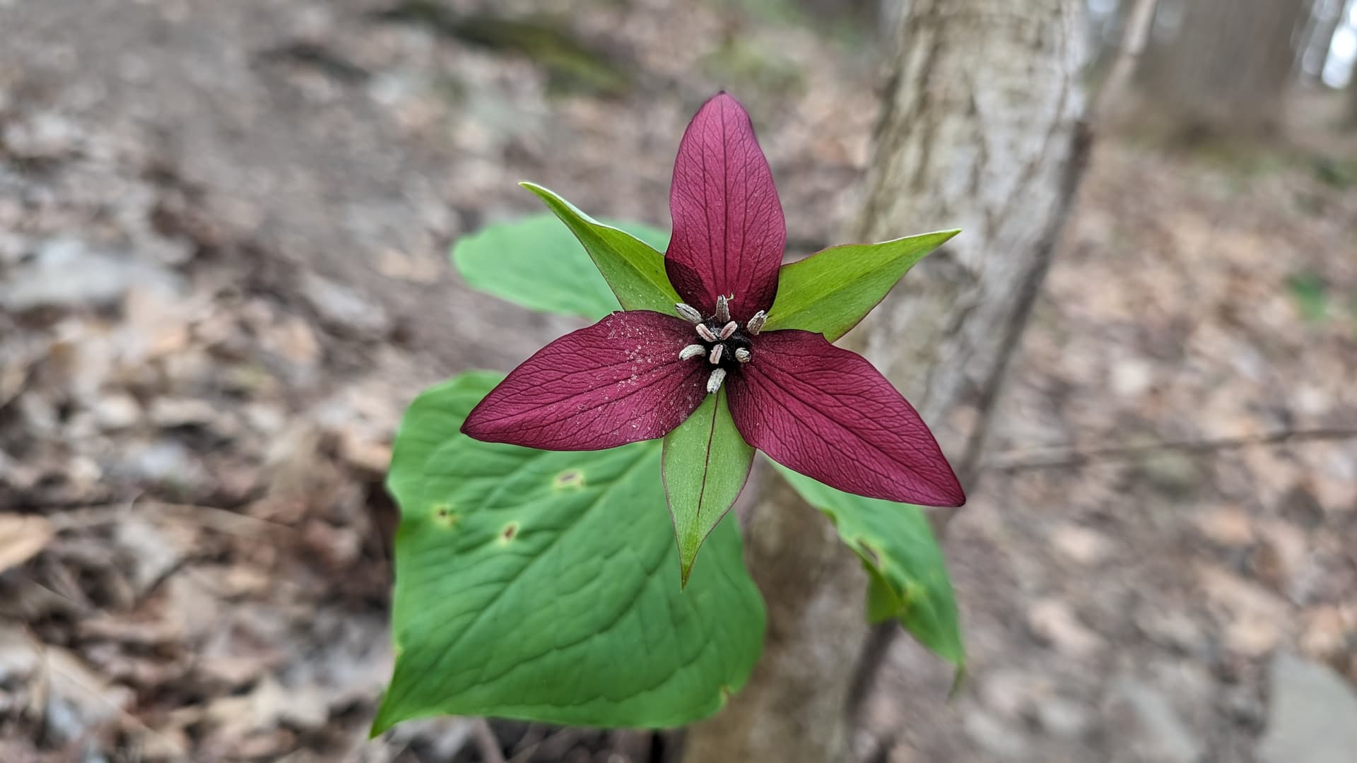
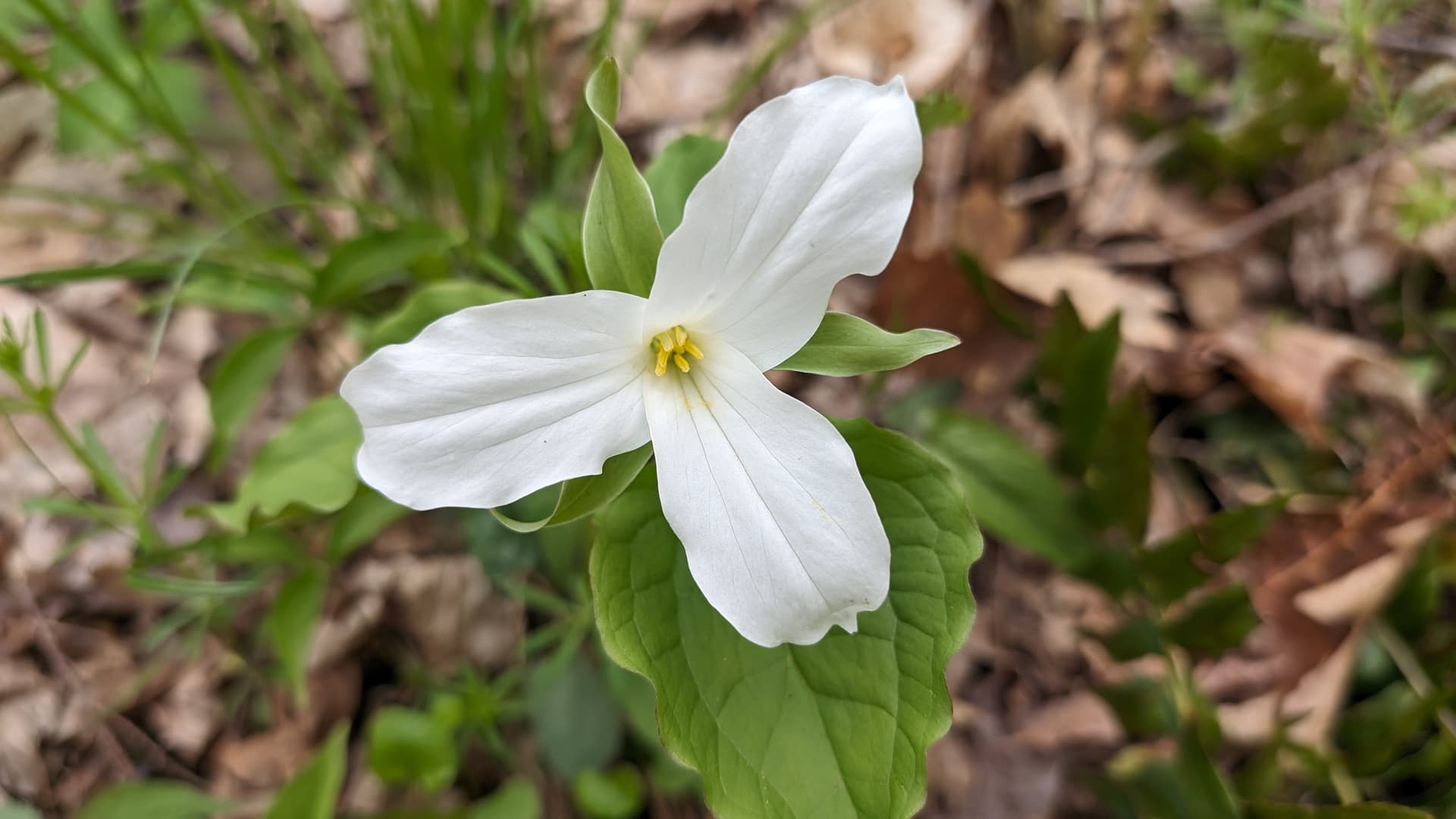
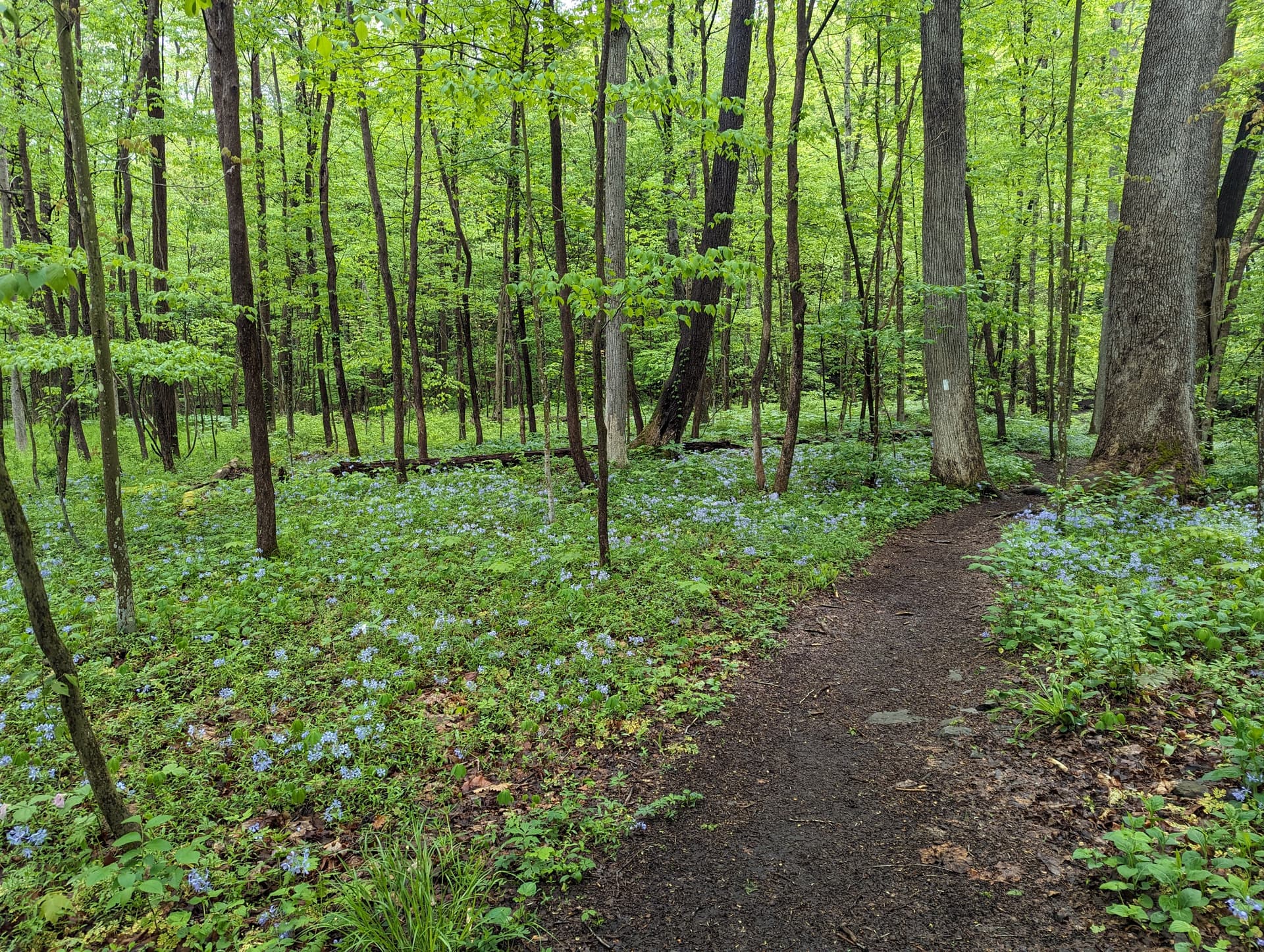
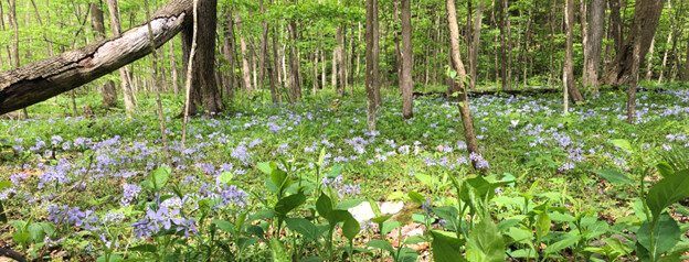
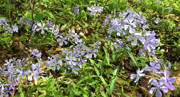
I pic’d so many wildflowers along the course, but I’ll just go with classic trillium:
I hope the railroad bridge is optional, since I bypassed it on the return leg.
The water felt so nice on my feet! Only calf deep at most and very clear!
Finger Lake Running Challenge? More like hiking challenge. That seriously kicked my butt. The trail was beautiful though, and I had a great time.
I haven’t been to the Brook Creek falls since the last time this trail was part of the challenge like 2 years ago, and I totally forgot how pretty it is.
The wind was chilly, but weather held out until about the last mile.
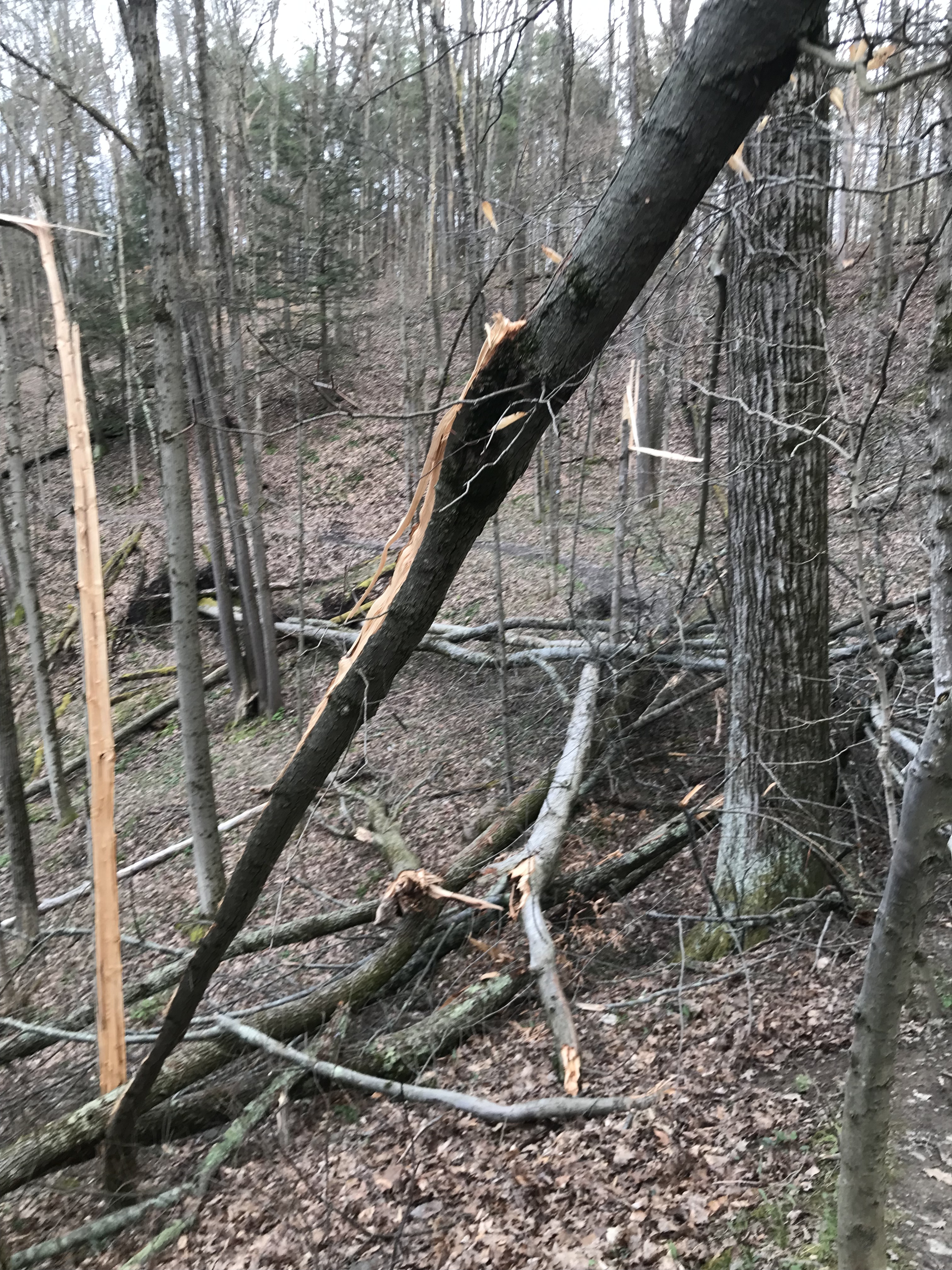
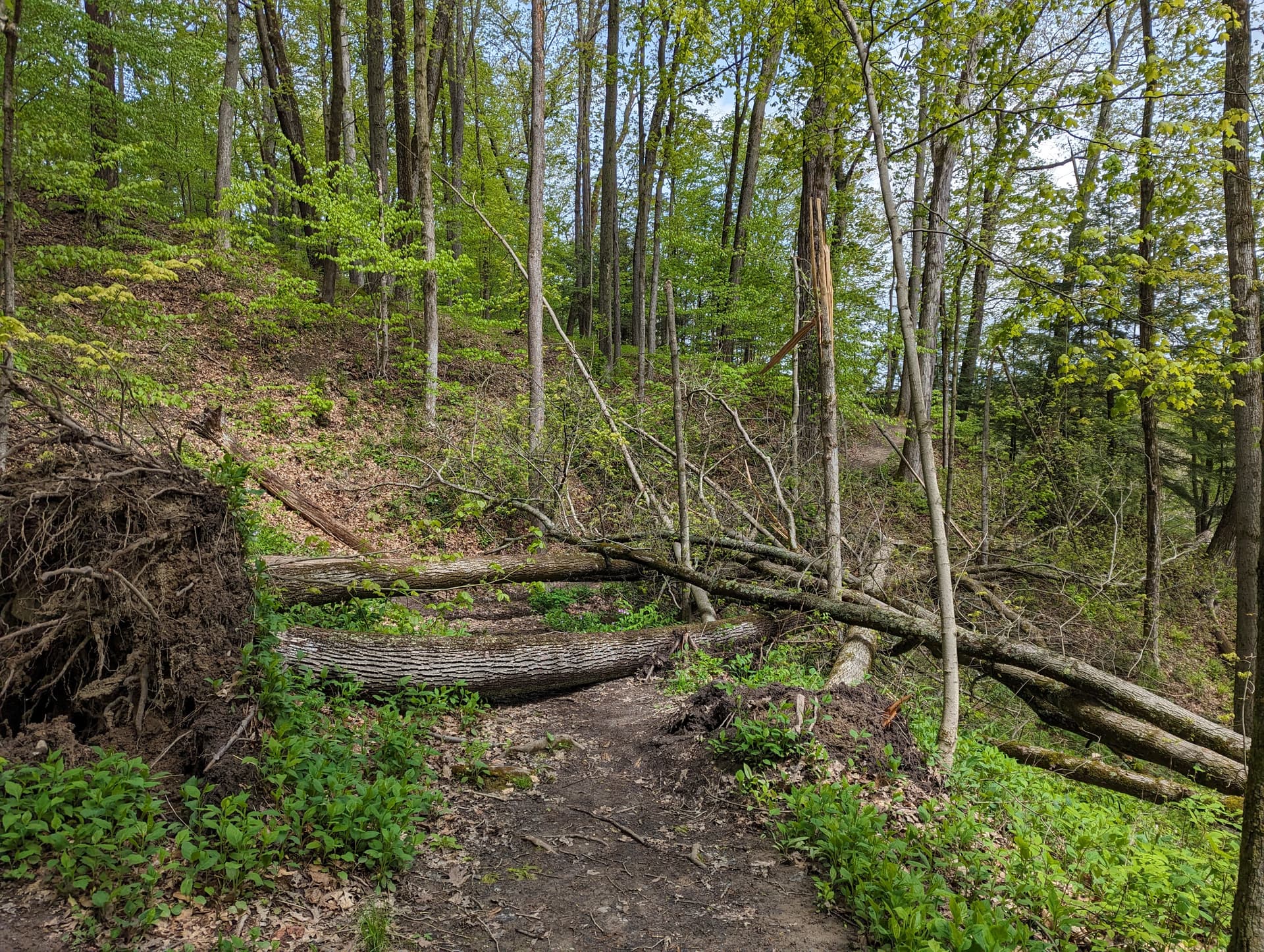
Heads up, there is a tree down on the Treman Lake section.
Took a friend with me today that’s never did a trail course and she loved this one. Met a few other challenge runners on the trail today and quite a few other people hiking in the great weather this morning.
Nice trail…should have looked at it a bit closer before going so I would have been more mentally prepared for the uphill… …I think maybe the switchbacks would have been easier… although I did get off course somehow and added on a good 1/4 mile more of straight hill than I needed. I must have felt that it needed more of a challenge in the moment? I definitely plan on repeating this later in the summer.
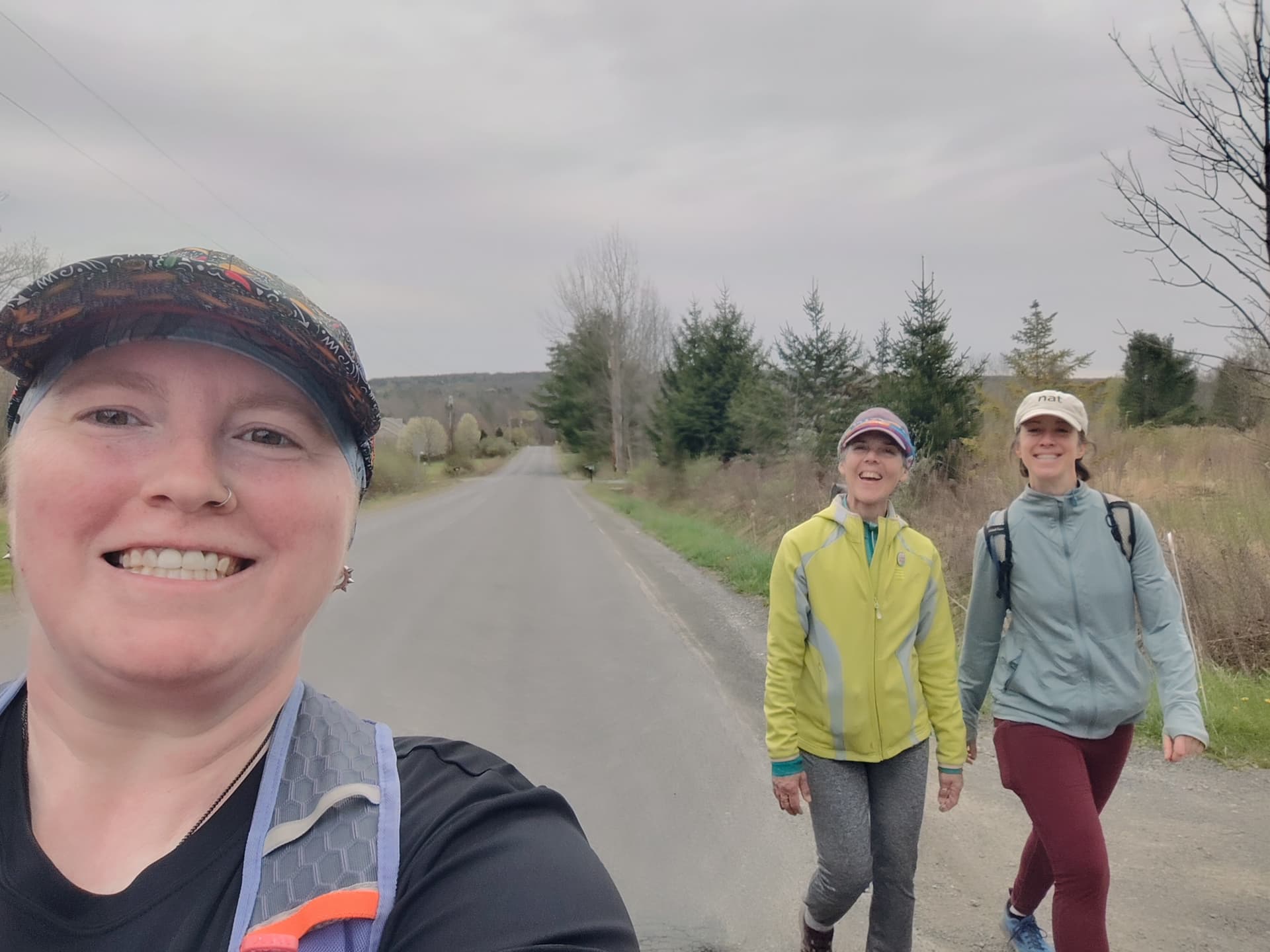
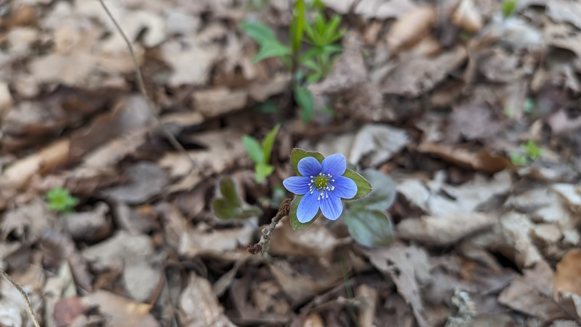
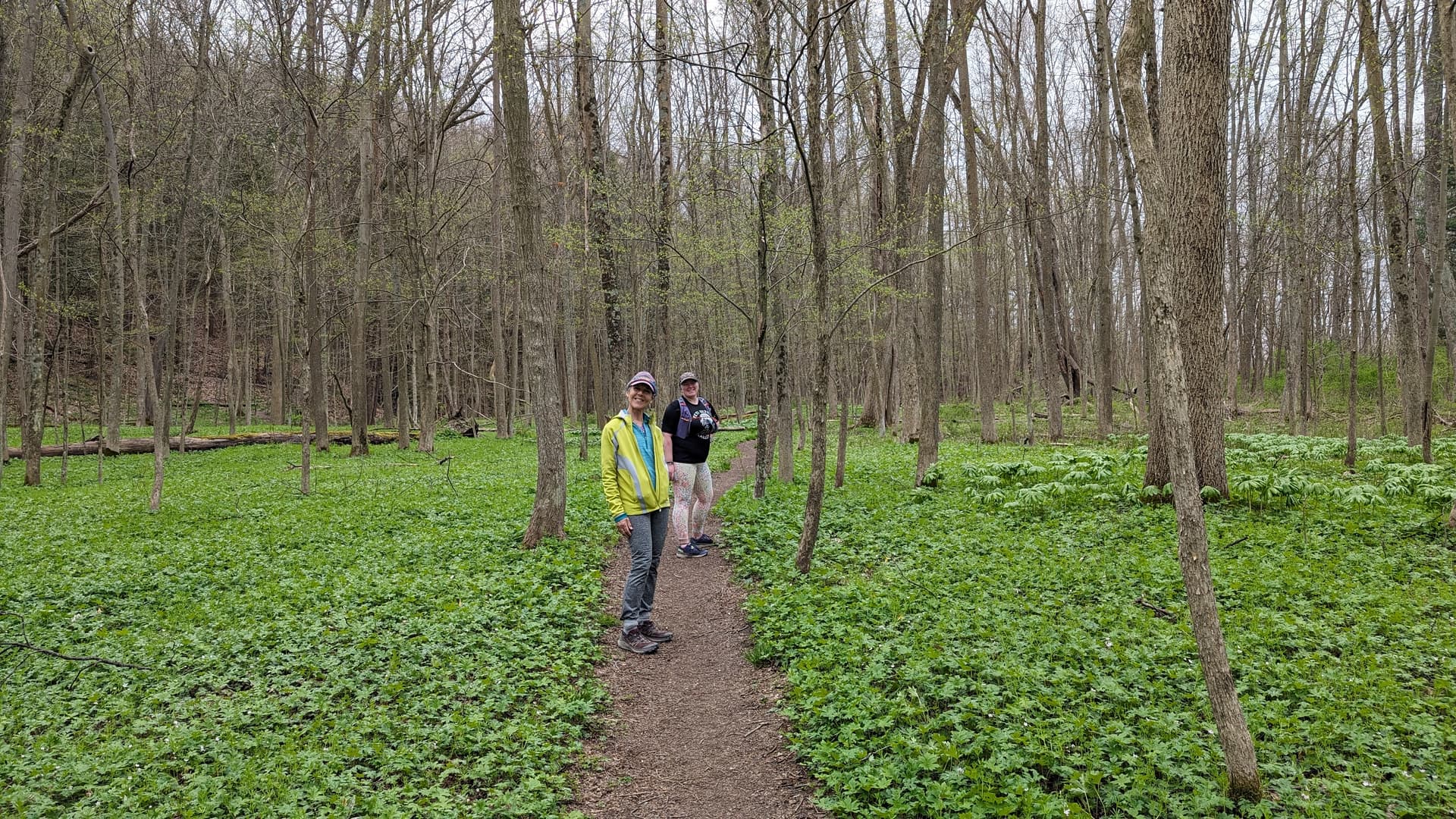
Had a lovely time on this trail with @heathercobb3 and @medardia today. The spring wildflower are on full display and we were all grateful to do those hills before it gets too hot!
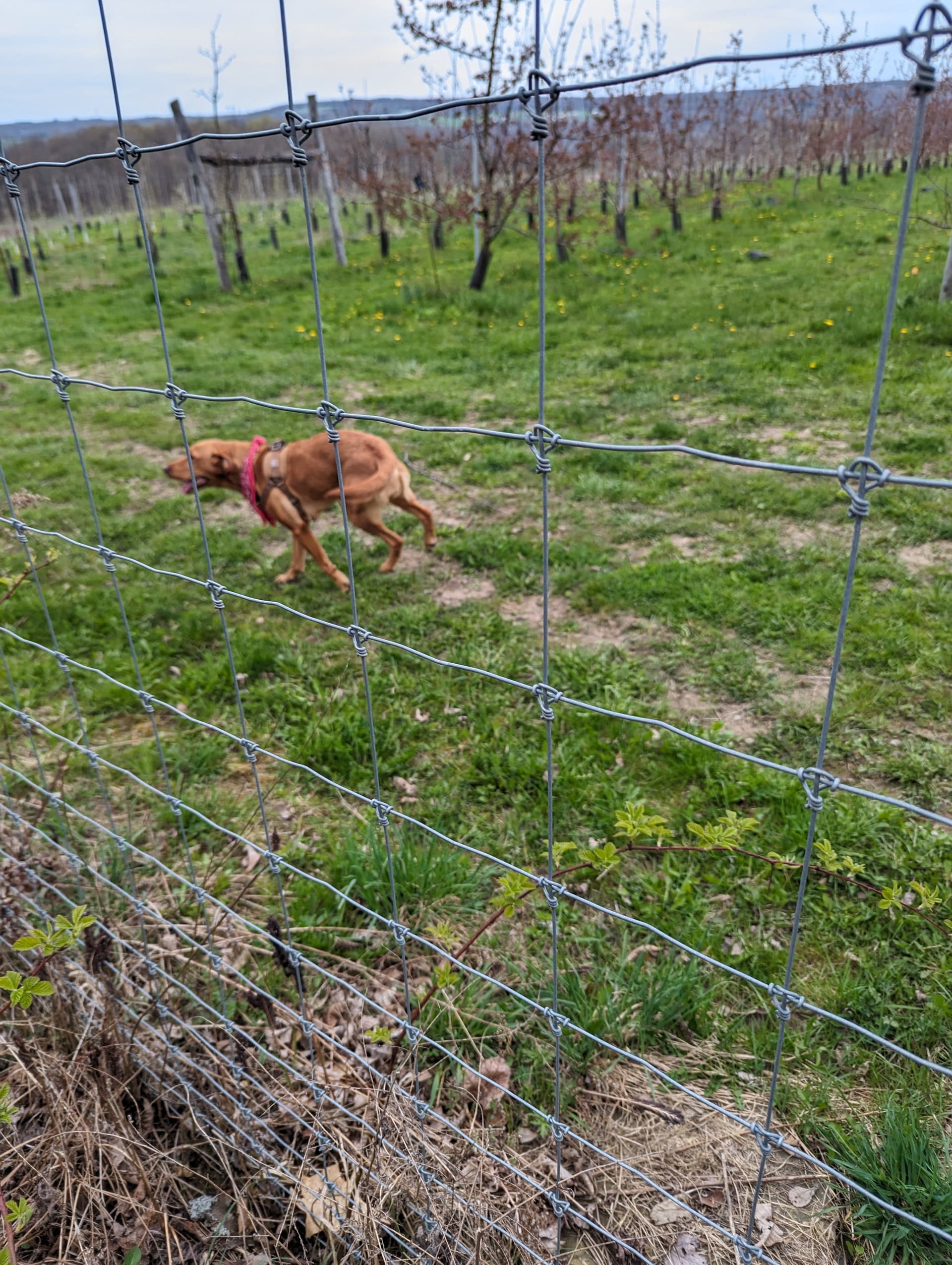
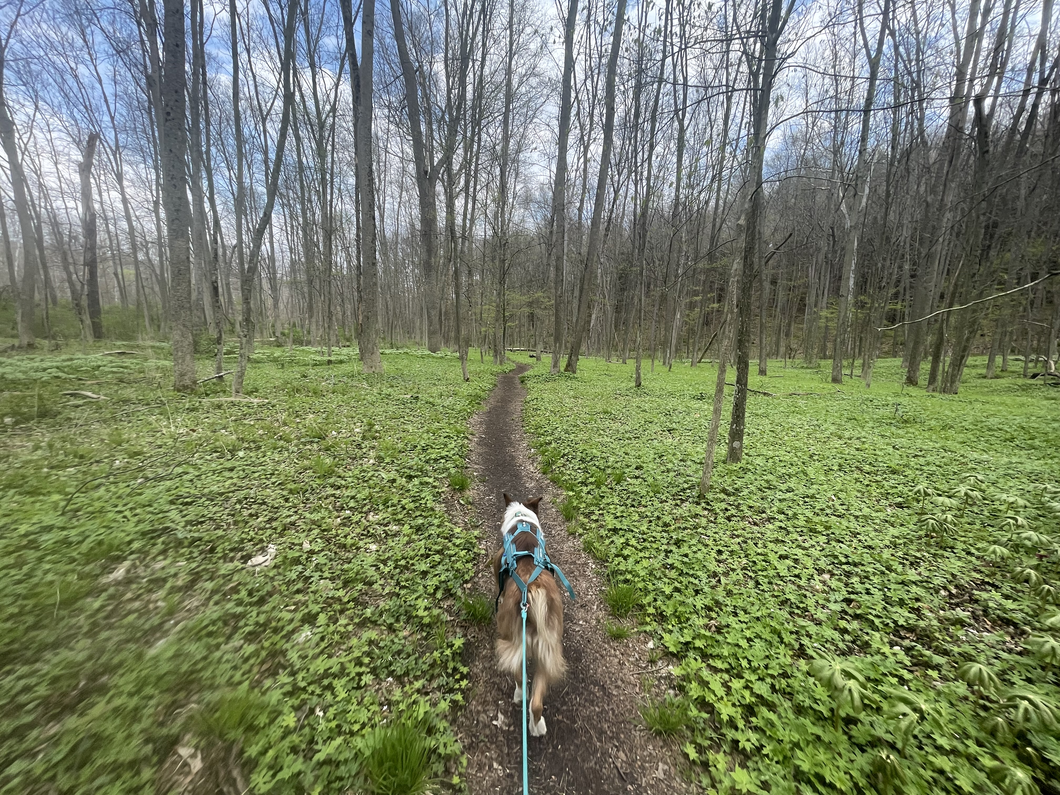
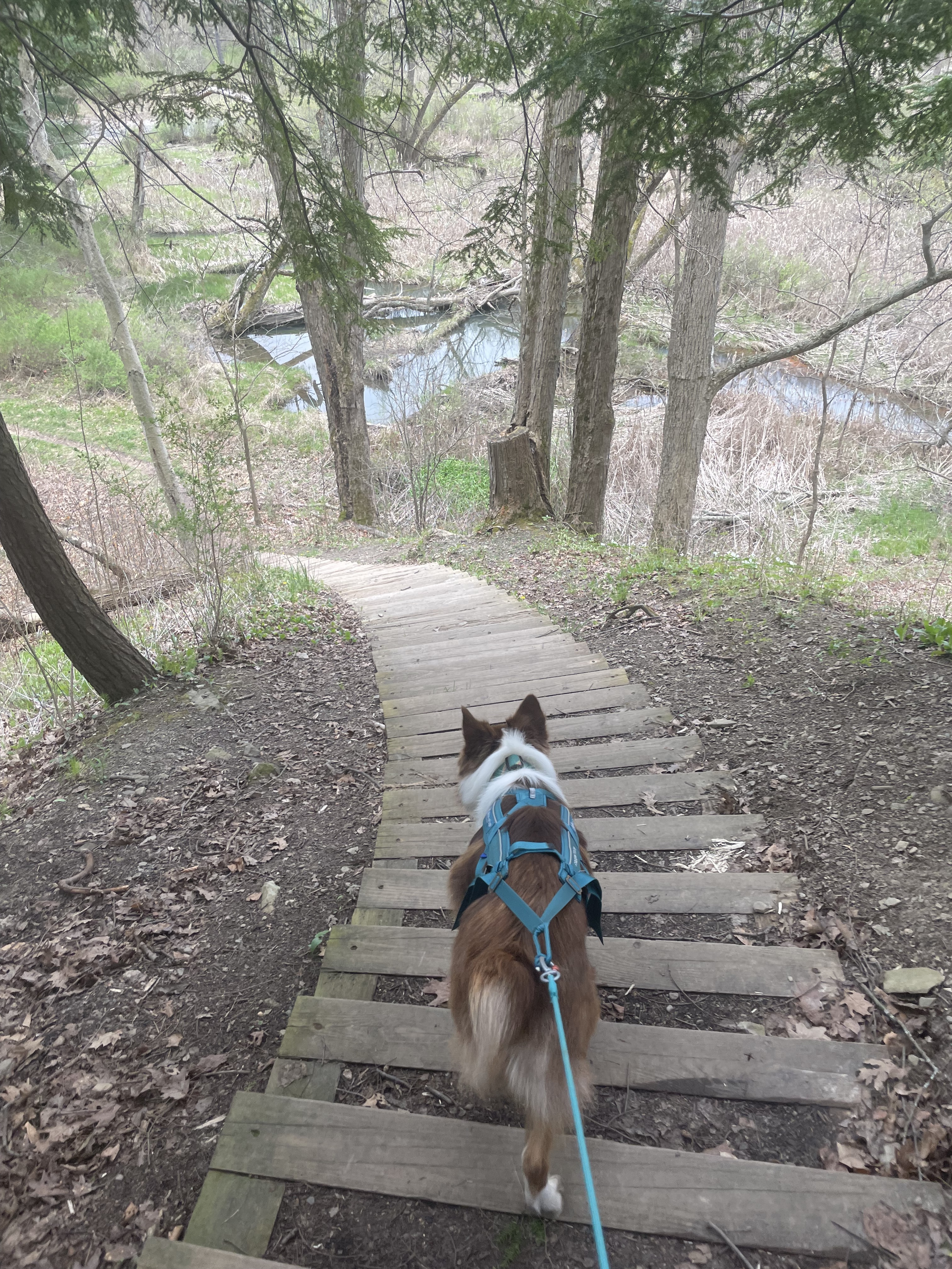
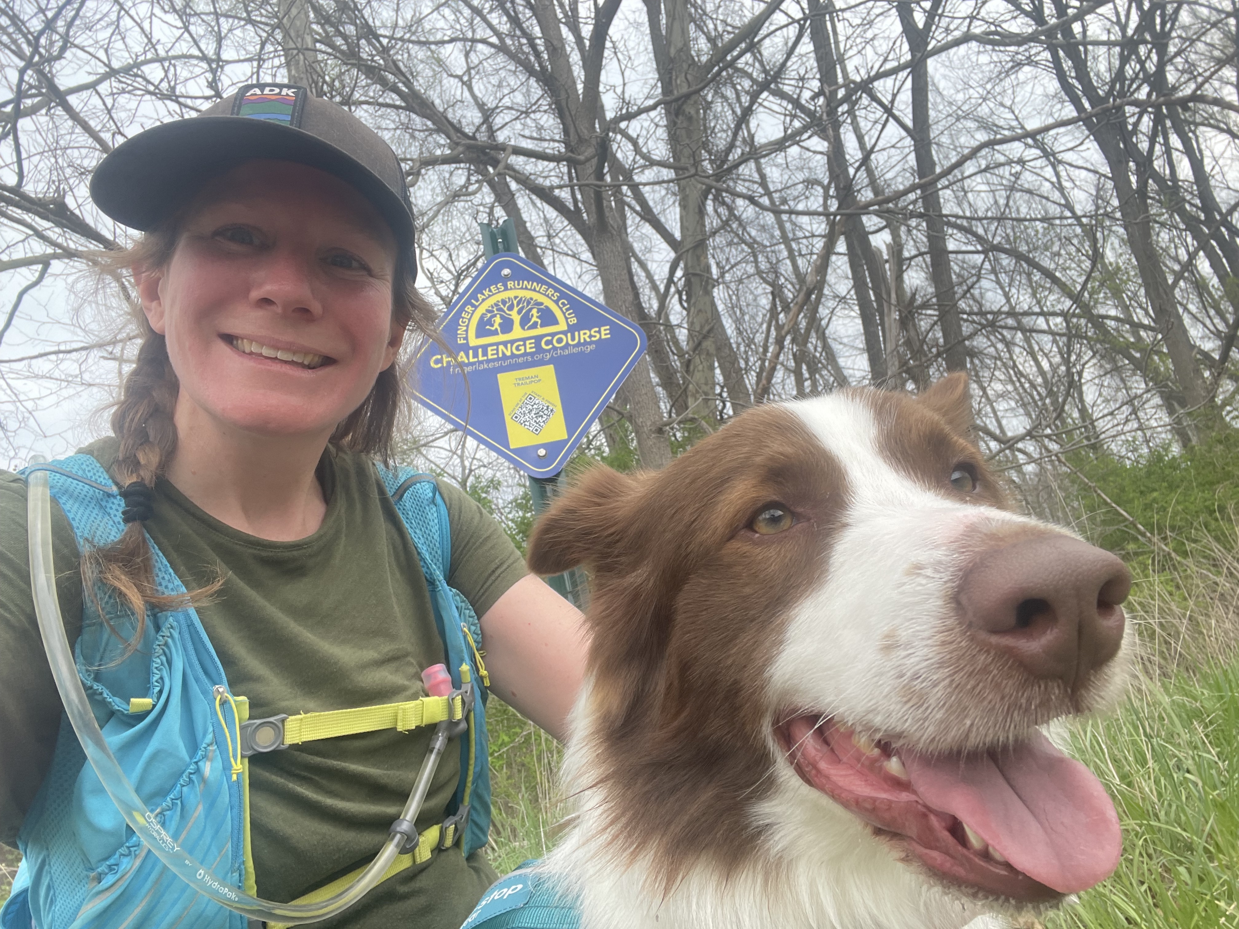
A nice overcast day to get out onto the trails with Frodo. Decided I’m going to try and get the more challenging of the courses done sooner (before the summer heat hits) than later if I’m doing them with the dog.
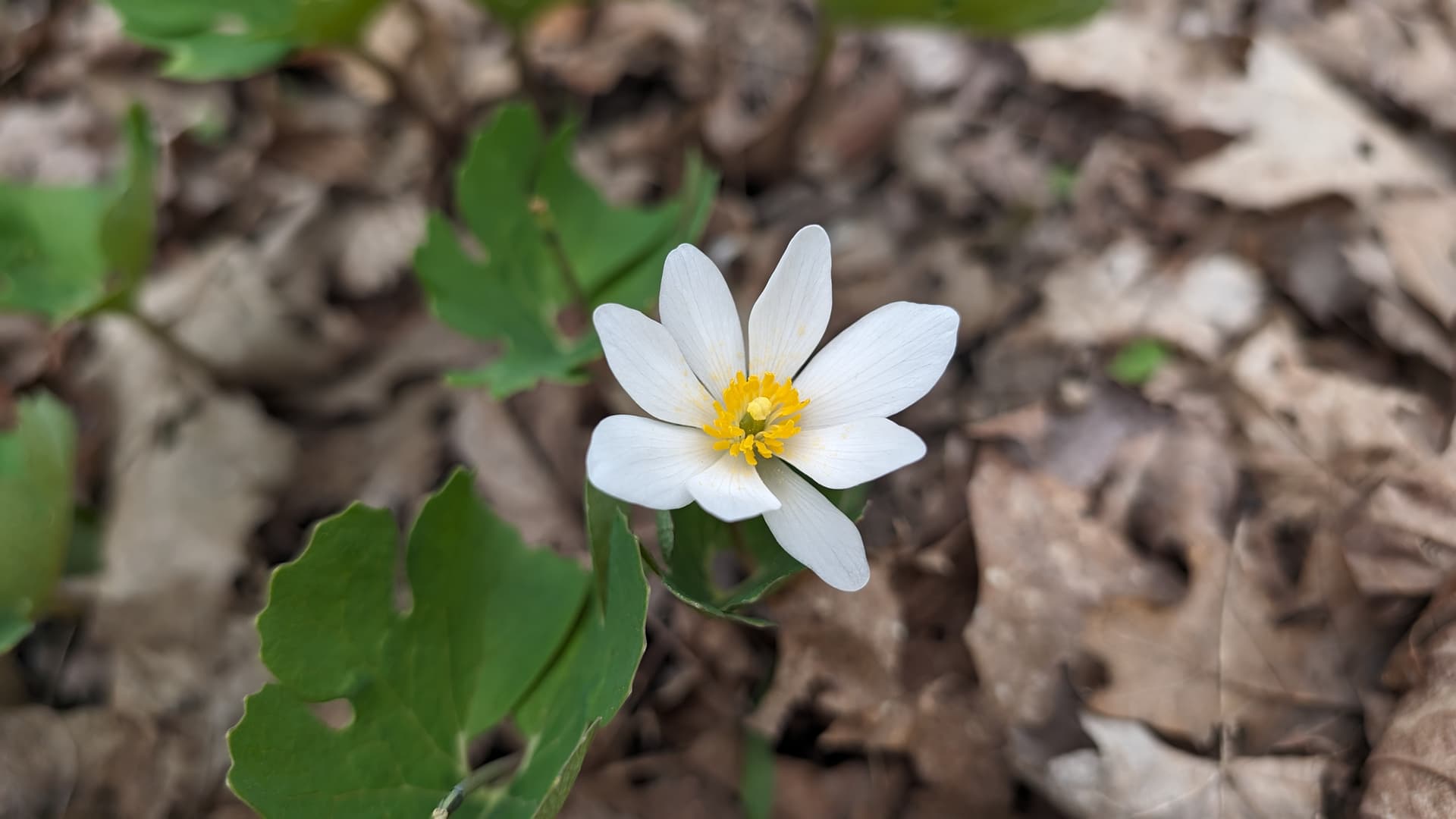
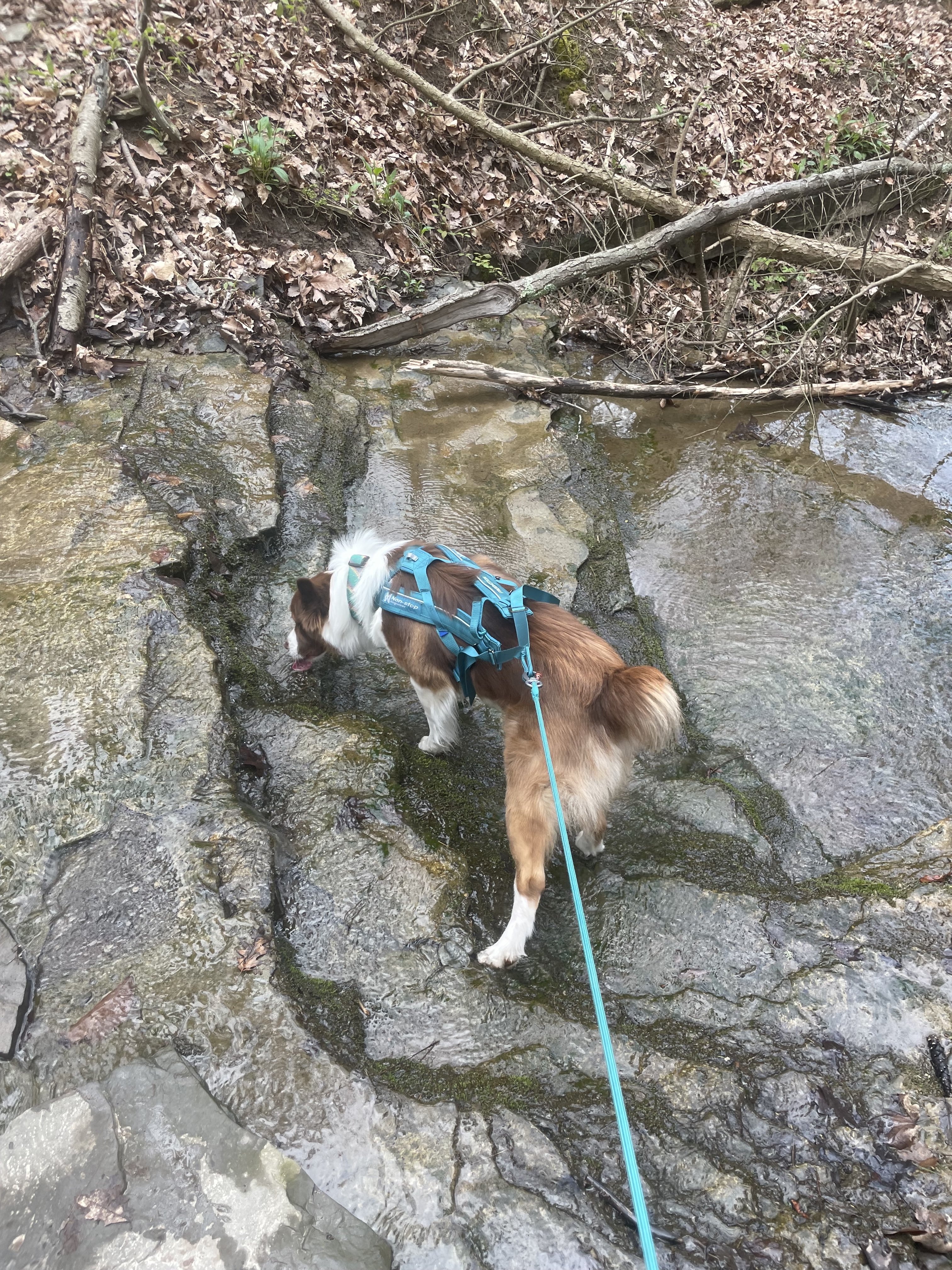
I made the very false assumption that Frodo would be pulling me up some of the hills to take off the burden boy was i mistaken! Instead he decided to stop and pee on nearly every tree stump, and take his sweet time smelling all the trilliums, may apples, sweet grasses and other dogs on the trail.
Once we got to the upper buttermilk section which he was more familiar with, we found a bit more of our flow with a slow take his sweet ol time run…and as relieved as I was to be able to finally go downhill, the way down was rather precarious being strapped to a dog and avoiding all the roots. All in all, a solid canicross adventure on some really beautiful parts of the local trail systems indeed!
In the spirit of the Challenge, I took on this route this morning as the longest run I’ve made in 6+ months…and only a week after the previous such run (Valley Views last weekend). However, it was familiar terrain for the most part (only the road section was new) so I planned on just taking my time and enjoying the trip.
It was a mostly uneventful trip, other the ongoing battle I am having with a particular running belt; it holds the phone nicely, but won’t stay tightened. I eventually gave up and wore it like a sling. But other than those stops, I trundled through the grasslands, tiptoed across the bridge and streams, and mostly hiked up the first two miles, despite encouragement from a couple of familiar faces going the other way (but apparently not doing this route). I started running only to encounter the first real mud by the yurts by South Hill Cidery…Realized at top of hill on the gas line, that I hadn’t heard the RunGo voice in awhile, so checked - I was still on course, but no voice. So I restarted RunGo and got proper directions…until I got to the top of the second stairs and didn’t get the expected “turn left” as that is a T intersection another trail coming in from the right. It was with much amusement that the left turn instruction came much later - tagged with “Check Instruction”…instruction is fine, location is bad!. There were two other occasions where side trails branched off that I expected guidance but RunGo was silent. But I knew the way. And then, as I neared the halfway point, I got an alert that I suspect was related to the twisty trail at the dam…but before I started the descent to the dam. None of this bothered me - I knew the trail well, but am aware there may be others relying on RunGo. The map is accurate, so I always knew I was on course.
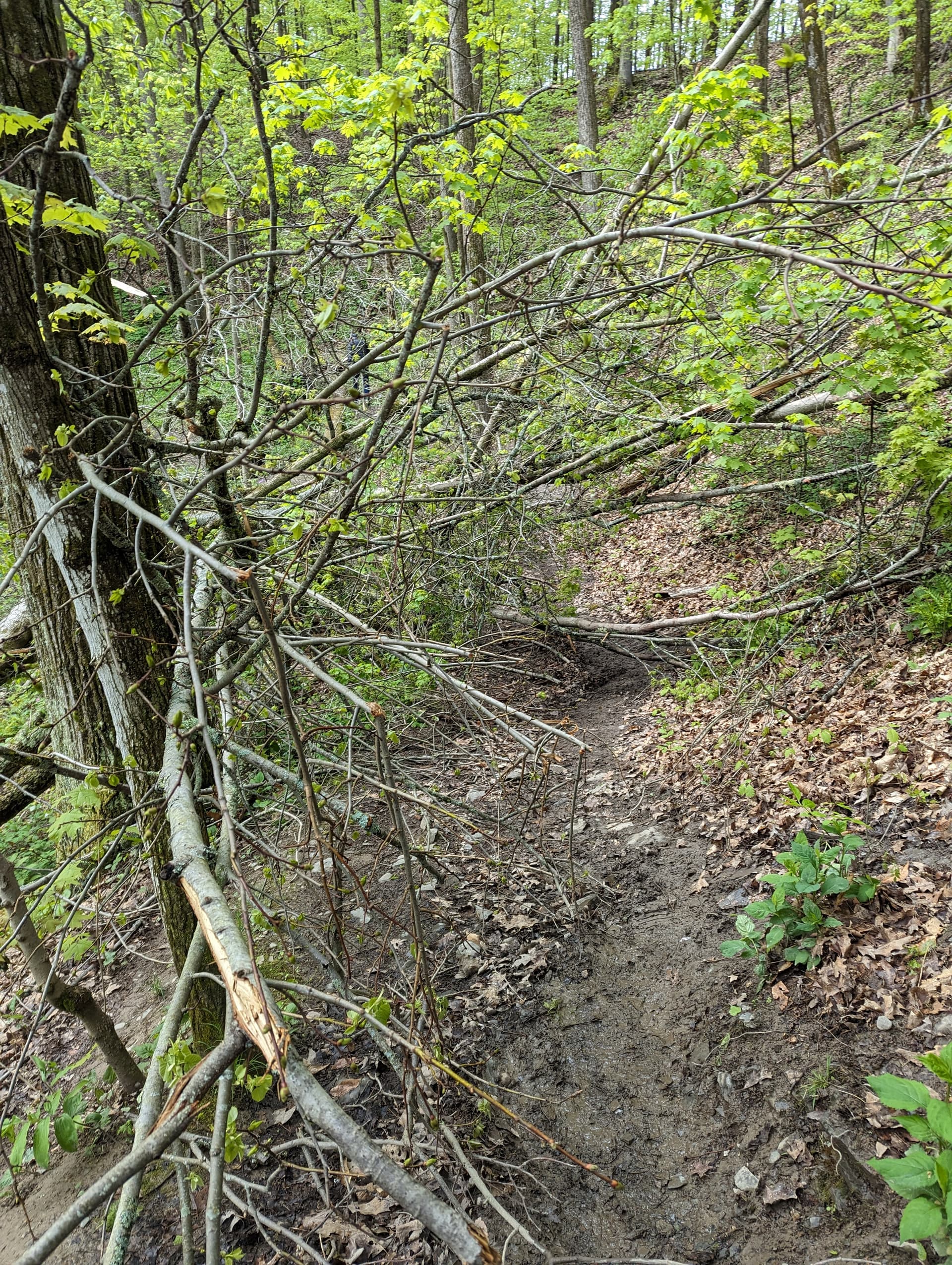
I crossed the dam without incident and started heading back up - only to encounter a several newly fallen trees blocking the path. The only recourse was to wind one’s way through the branches and trunks. At one point, I noted from the tracks on the trail that several people had fallen after crossing a trunk so I carefully stepped past that point (long legs!) - and went down myself. Oh well…it wasn’t a hard fall, just embarrassing.
At this point, I was actually running - just in time to encounter the first set of hikers going the other way; they appreciated the fallen tree ahead warning. Most of the rest of the run was uneventful…I was just happy to be running. I really had to push on the last flat 1/2 mile because I was feeling the distance, but I made it back in my goal time - yay! Strava activity
Sorry about the directions—I’m doing them blind this year. I’ve moved the first one you mentioned back on the trail a bit, but it’s just a guess. If someone can tell me the exact distance where an instruction should come, that would be a help.
I inadvertently saved the hardest (imo) for last
Came across a few other challengers but didn’t get names but HI AGAIN!!!
This course was without a doubt the most beautiful and stunning and…EVIL course so far.
I hiked it, and I always say I’ll go back and run them again, but I throw my hands up in surrender at this one this is beyond my novice trail running skills, level expert needed
But I will be back.
So, I found this course to be the most beautiful this year. The Lick Brook section was new to me, and I was completely caught off guard by the waterfall no idea it was there.
In all honesty I knew this was coming, I’m very familiar with the treman lake trails, just thought it was funny.
Had to take pictures of what I lovingly call Helms deep
There are a couple sections that have a narrow trail with cliffs on each side. Be careful runners
Also the down trees across the trail were tricky just hiking
Adam:
Funny you should mention that - I noticed that my Strava had a datapoint right at the top of the stairs, so from the GPX, I pulled the following:
trkpt lat=“42.3975190” lon=“-76.5088230”
Looking at (42.3975190,-76.5088230) on Google Maps (which shows the trail) seems to be about right…
Let me know if this helps - if so, I can try to pull a datapoint for the second instruction (if it indeed is as I suspect, warning about the turns around the dam)
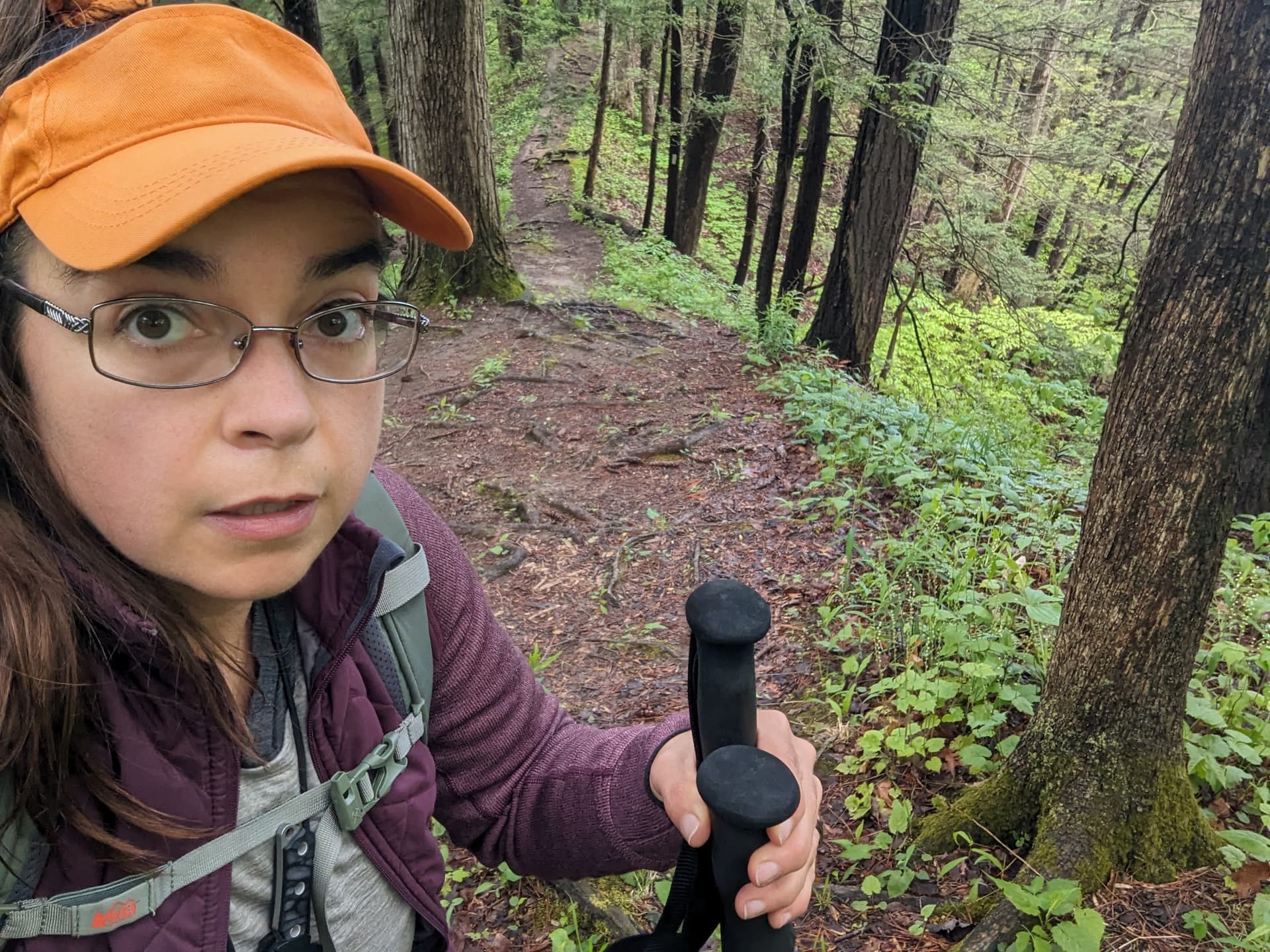
Melissa: I was the old man in orange jacket happily descending as you were starting to climb…thanks for all the pics! And congrats on the Challenge completion!
Bob
Perfect! Yes, that’s helpful, and I moved the direction to where you indicated. (My guess was a lot closer this time.) If you can compare the second one against the directions and give me another point, I can tweak that too.
My husband and I decided to hike this one. We are training for the 20 mile Mammoth March in Letchworth, so this was a good chance to put some miles on my hiking boots. It was a beautiful day, and we met one other challenge runner on the course!
I concur with Melissa’s note that this one was hard. RunGo stopped completely on my iPhone at the dam, but continued on my watch. Luckily, I know upper Buttermilk well, and the watch RunGo directions got us back to the parking lot. All this added to the sense of adventure.
A Trail Too Far
It had turned into a very nice afternoon, so after 17 miles of other courses, I thought why not check out Treman Trailipop. Last week’s adventure in the Hudson Valley doing a Red Newt trail event took longer than normal for my legs to recover, but I was feeling pretty good so far today. All the picture taking afforded plenty of rests. The short of it is, the wheels came off and it was a hike far more than usual. The good news though is that Lick Brook Falls is still stunning!
And, the wildflowers lining the trail before and after passing the falls are beautiful and abundant!
As I approached the second creek crossing near the base of the falls, two hikers reported a 3 feet long snake, that seemed to be molting, on the trail on the other side of the creek. I had my camera ready but, unfortunately, it had made its way into the grass.
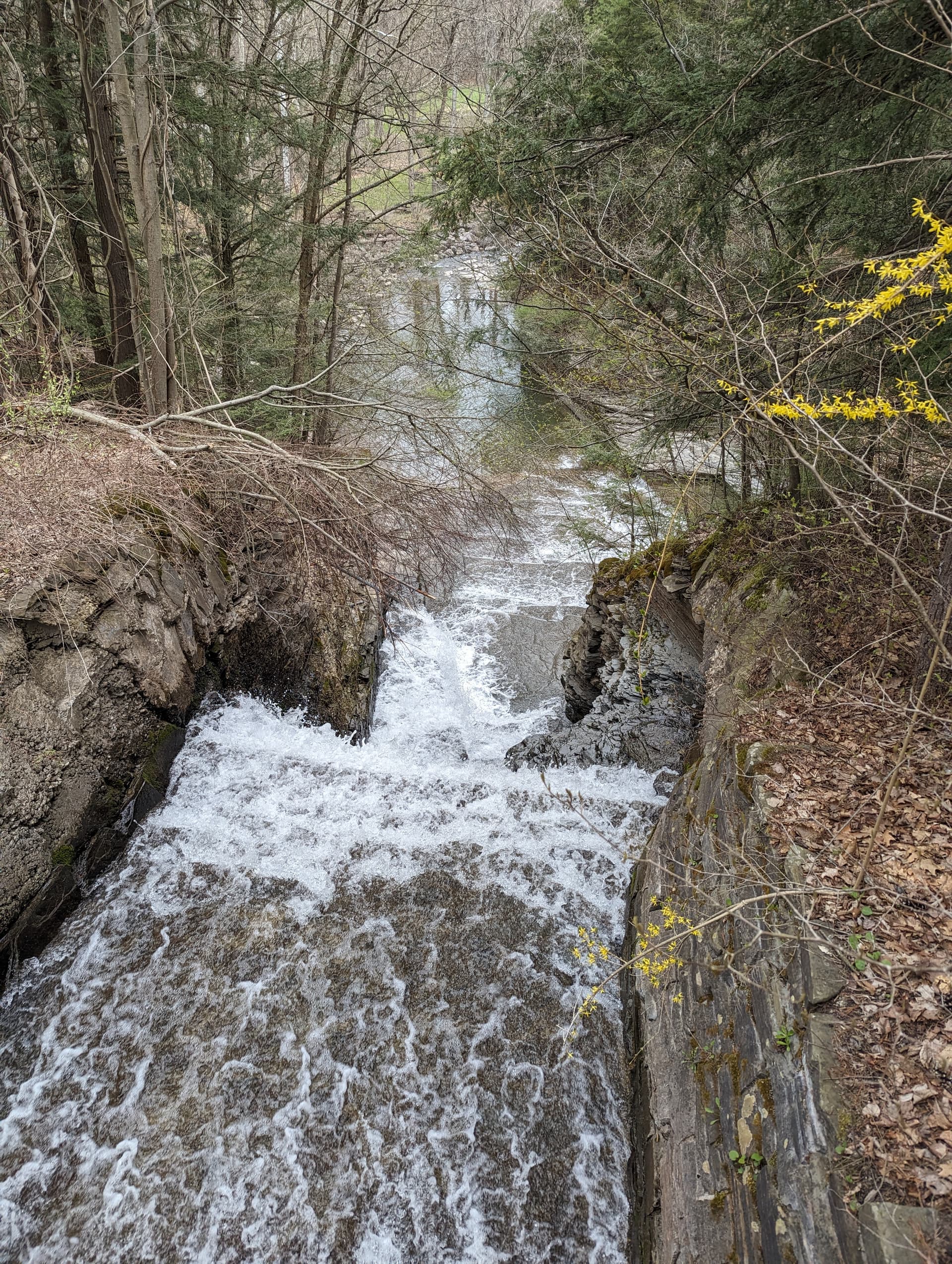
The other ravine on the “bypass” climb is still flowing with many cascades. There are a couple of places to see the long cascades. In some ways, I like these more than the Lick Brook cascades and really do need to bushwhack in there for a closer look!
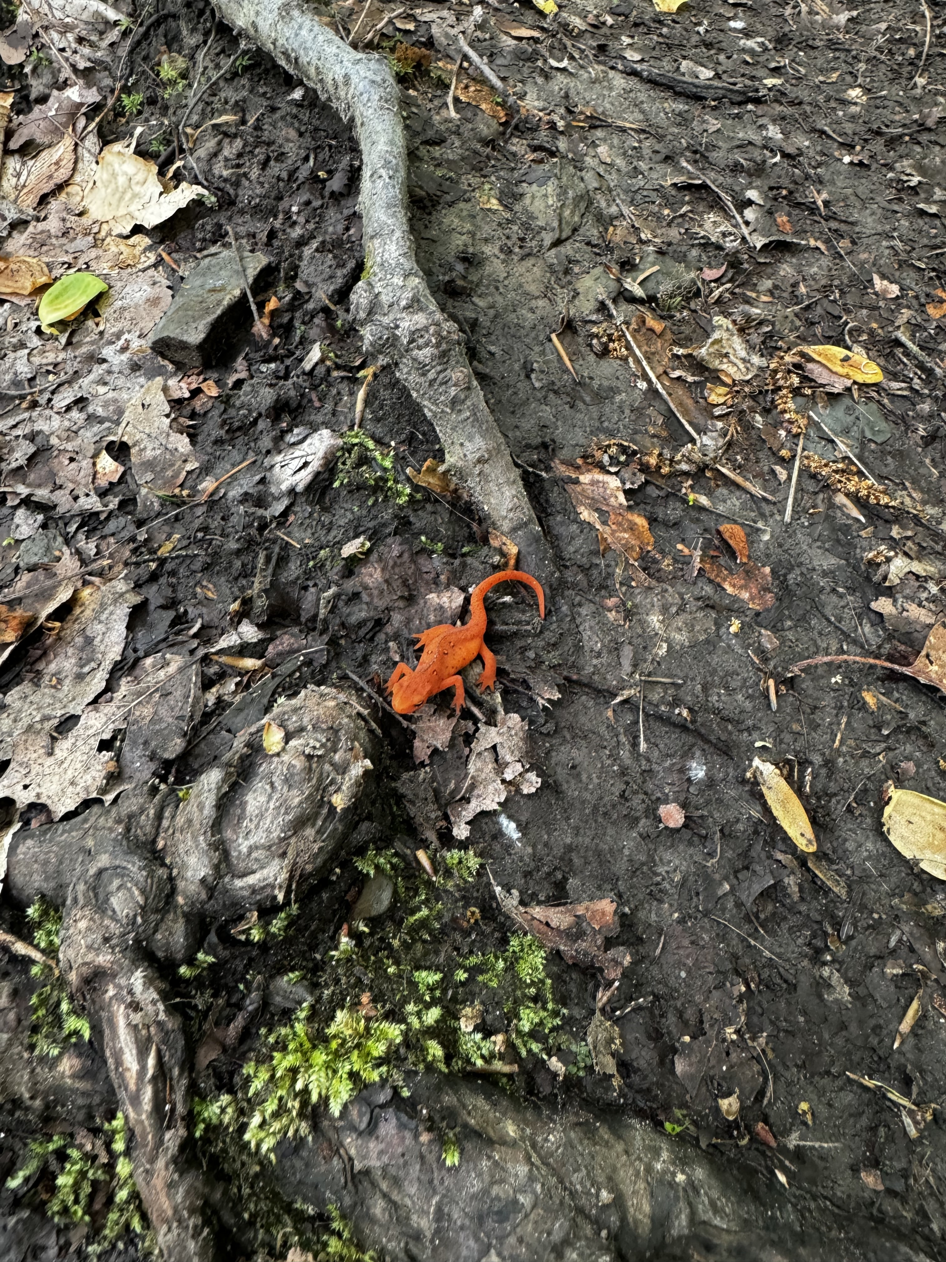
This was my first time running an FLRC Challenge course! This was a great route—I’m always a big fan of linking up different natural areas, parks, forest, and trail systems with one big trail run. With all the rain we had over the weekend, parts of the FLT were real wet with sticky mud, otherwise the conditions were great today. Nice cool air and lots of red newts out and about. The descent on the FLT through Sweedler has to be one of my favorites in the area~such a narrow ridge! I personally like going up the switchbacks and down the FLT ridge, but climbing the ridge was fun today. I’ll be back to try to get a better time on this one!